I dont doubt the capability exists to manually verify the route controls have been visited , the question is are they?
The validation tool does not do it automatically and FF (not a DIY org but closer to these things than I ) thinks it a nonsense to do this manually, so what is the situation?
If the tracks are not being validated for controls then it makes DIY GPS perms purely a distance exercise and makes having controls irrelevant, which is not what its supposed to be about, is it?
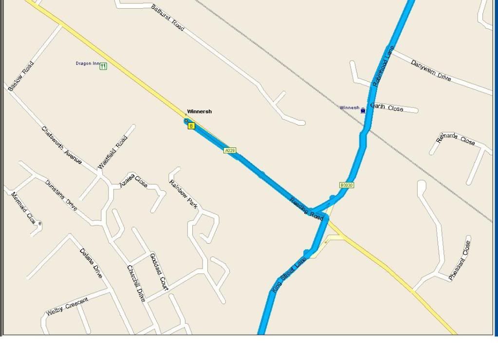
My main point is that even with gps diy system there is (currently) no clear and consistent method for defining where a control is in the first place. For example the graphic below from Autoroute10 shows the 'by controls' path used for a calendar event that visits Winnersh. However the actual control is on the junction. The path stub to the waypoint is worth 500m. The same situation can exist in reverse. All of these errors add up. It gets more interesting when different mapping systems are used to design and validate routes, adding error on error, and make a nonsense of any claim to precision relating to 'minimum distance'.
p.s. That looks like a great route, by the way, Rich! The current version is ~202km 'by controls', ~217 'on the road'. So those riding the route in say, January, will enjoy a hour of after dark winter riding gratis.

