Author Topic: Solo Brussels - Kefalonia 3 week tour (warning - lots of photos)  (Read 4993 times)

αdαmsκι

  • Instagram @ucfaaay Strava @ucfaaay
  • Look haggard. It sells.
Solo Brussels - Kefalonia 3 week tour (warning - lots of photos)
« on: 04 September, 2014, 10:36:15 pm »
Prologue


I’ve never done a multi-week cycle tour. Nor have I have been to Greece. These things needed rectifying, so in April I booked a budget flight from Kefalonia to London. Now I just needed to figure out how to get to Kefalonia. After some consideration I decided to take the Eurostar from London to Brussels and start the ride from there rather than riding across Kent. The planned route would then see me ride across Belgium, into Germany and picking up the Danube River in Regensburg, which I would follow until Vienna. From there I planned to head south-west to Szeged, in Hungary, before turning south to cross Serbia and Montenegro and then entering Albania, my final country before Greece. There is a ferry service from Sarandë to Corfu, which seemed an interesting way to approach Greece.

On Monday 28th July I dropped off the bike at St. Pancras station and crossed my fingers it would be put on the correct train the following morning. I cycled home on a Boris bike and spent an apprehensive evening wondering what was in store for the following three weeks.
What on earth am I doing here on this beautiful day?! This is the only life I've got!!

https://tyredandhungry.wordpress.com/

αdαmsκι

  • Instagram @ucfaaay Strava @ucfaaay
  • Look haggard. It sells.
Re: Solo Brussels - Kefalonia 3 week tour (warning - lots of photos)
« Reply #1 on: 04 September, 2014, 10:39:16 pm »
Part 1: Belgium to Hungary
Day 1: Brussels (Belgium) to Heimbach  (Germany) Route on Ride with GPS

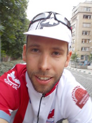
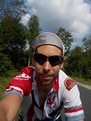
After a snooze on the Eurostar I was in Brussels, as was my bike. Yay! It was grey outside. Boo.
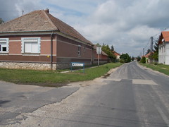
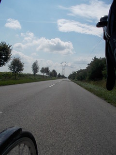
I set off from the station and was surprised how quickly I escaped the city, but then I was comparing it to cycling out of London. Being Belgium the road signs were in Flemish and French.

The greyness remained as I cycled through fields of sweetcorn and across the Meuse. I stopped to get my bibons filled up from a women in a village and when she discovered I was cycling through to Germany she went to get me some food. I managed to avoid accepting her generosity by showing her the food I had in my jersey pocket.

The greyness then turned to blackness and a massive thunderstorm started up, but fortunately it wasn't actually that cold and I managed to find somewhere to shelter while I donned my waterproof. I then came across 
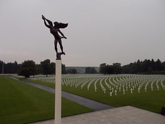
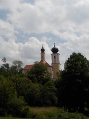
the Henri Chapelle American Cemetery. The cemetery was empty and peaceful, until the silence was broken by a recording of The Last Post. Standing there on my own listening to the haunting music was a poignant reminder of the ultimate sacrifice made by so many young people during WWII.

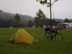
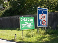
I then got very confused about whether I was in Germany or Belgium and it wasn’t until a few days later I realised I had cycled through a German enclave. Once back in German I climbed up the Eiffel Mountains, enjoying the evening light and gradual climbs. The final descent into Heimbach was wet and I remember mentally telling myself to be sensible on the descent. The campsite I found had a bar, which meant I could easily get fed, and spent some time chatting to a Czech lady who was cycling back to Milton Keynes where she lived. She had a bivvy bag (but a Dutch family let he sleep in the back of their estate car that evening!), very little other equipment and was essentially surviving on fruit as she’d recently become vegan. Suddenly my plan seemed quite sensible.


Day 2: Heimbach to Frankfurt Route on Ride with GPS

It rained a lot during the night, but I don’t know if it was that, or the thunder or lightening that woke me up at various points during the night. Probably all three at separate times, but the new tent was fine, and fortunately the rain had stopped before morning, but it was still misty.

However, the little streams were exploding onto the roads and teams of people were out trying to control the floods.

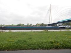
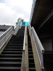
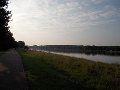
There was a lot of gradual climbing and pretty villages. Around midday I entered the Rhine Valley. I’ve seen the Rhine many times before and yet the size of the river still amazed me. I stopped in Aldi to buy lunch, but I wasn't allowed to buy my apples because I had forgotten to get them weighed. However, someone saw this & she bought me an apple & gave it to me while I was stood outside Aldi repacking my bag, which was sweet. I then had to cross the Rhine and wasn’t impressed I had missed the access road to the bridge as it meant I had to use the stairs.

After the Rhine there was more climbing, up to the high point of the day of 720 m, which was just a road outside of Frankfurt (in comparison The Cairnwell goes up to 670 m & the Bealach na Bà is 625 m). There were a decent number of people out of racing bikes, who I assume had ridden up after work from Frankfurt. One could get very fit with such a hill as a training ride.
   
After skirting through the Frankfurt suburbs, for which I was very thankful I had spent some time creating a sensible track to load onto the Garmin, I was at the Campingplatz Mainkur, which was set right beside the River Main (and a dual carriageway on the other side).

Day 3: Frankfurt to Zirndorf Route to Gollhofen on Ride with GPS

It was sunny when I woke up this morning and I enjoyed the cycle along the Main River. I stopped at the first open bakery for breakfast and continued along enjoying the sunshine and shade when passing through the woodlands. Cycling in Germany really was very pleasant.

I had a climb up to around 500 m to tackle, which was fine, and then a long gradual descent through a deserted wooded valley back down to the Main. That section was fantastic. I then recrossed the Main, and then got my first glimpse of vineyards.

Up until this point I was doing as instructed by my cap, and having a good ride.

However, after a cycling along the Main through Würzburg I heard a sudden load crack noise and I instantly realised a rear spoke had snapped, or rather exploded. The wheel was badly out of true, so I immediately stopped. It was a drive side spoke, so I would have to remove the cassette to do any proper repair. I bodged something up using an emergency spoke and rode to the next village, which was 1 km away. There a car mechanic told me there was a bike shop in the next town and he happily drove me the 4 km. However, the owner / mechanic of the shop was in hospital, but his wife let me use the workshop. The friendly car mechanic stayed around and we managed to get the spoke replaced, but I wasn’t happy with the job and the wheel was still out of true. I had arranged to stay with a couple in Zirndorf via Warm Showers, so was wondering what to do. Pippa, in London, realised I could take a train the 50 km and get the wheel sorted in the morning, so that's what I did. Riding another 50 km on a damage wheel would have been silly.

After a train trip I had a relaxing evening in Zirndorf with my WarmShower hosts. This was the first time I’d used WarmShowers and it was brilliant. There was also a bike shop in Zirndorf where I could go in the morning in the hope they could sort out my rear wheel.

Day 4: Zirndorf to Straubing Route on Ride with GPS

I turned up at 
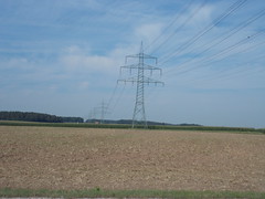
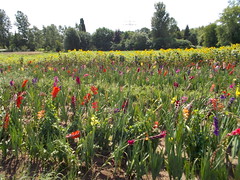
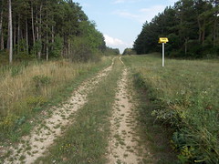
Bike Devilz when they opened and within 30 minutes I was on the road again. Thanks guys. The ride out from Zirndorf involved lots of big open fields and massive skies. The fields all have wild flowers growing along their edges, which was beautiful to see.

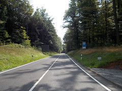
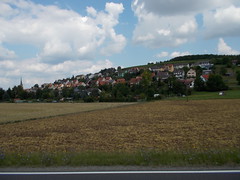
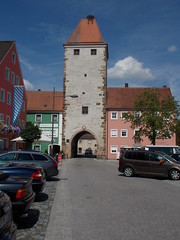
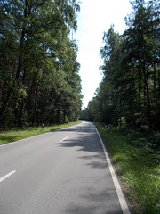
After that section I then entered more forests with big, long, roads. It was tough going because of a headwind and a lot of false flat, but pleasant nevertheless especially as the trees provided me with a lot of shade. I stopped in beautiful Freystadt to refuel at another bakery. The churches started to look very orthodox in style, which gave an impression I was heading eastwards.


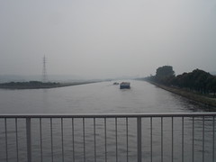
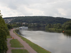
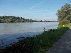
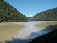
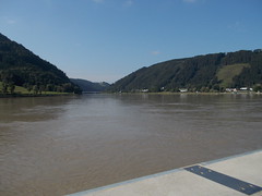
Just before Regensburg I caught my first glimpse of the Danube, which I would be following for the next few days. Suddenly reaching this famous river felt magically, especially after the problems of yesterday.

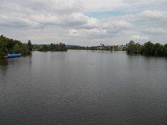
I followed the Danube for about 50 km to the 
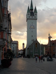
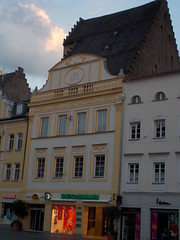
campsite just outside Straubing. There were loads of people out on all sorts of bikes, from carbon race bikes to people pulling along kids and the campsite just had more and more people arriving on bikes. The assortment of luggage was impressive. As were the mosquitoes, which is the downside of camping near the river. In the evening I walked into Straubing and was not expecting the town centre to be a medieval gem with people sat in the main square eating and drinking. The atmosphere was fantastic and I thought about what towns we have in the UK: Swindon; Milton Keynes etc. Hmm….


Day 5: Straubing to Mauthausen (Austria) Route on Ride with GPS
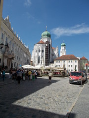
This morning I woke up and was sad to know I would soon be leaving Germany as I had had a fantastic time cycling across the country. I’ve been to Germany a number of times before, but I was still surprised at what a fantastic country it is for cycling. However, before I would leave I had about 90 km to ride from Straubing to Passu and it was another fantastic morning.

After 10 km I found an open bakery, so that meant breakfast time and I then carried on my way to Passu, following either cyclepaths or empty roads. Passu centre was lovely; and hot. I found a drinking fountain and dumped my cap into it in order to cool down, and another cyclists followed suit.


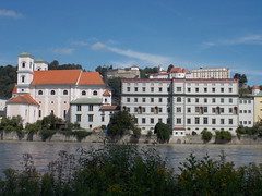
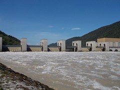
After Passu I was in Austria, and for about 30 km I following a relatively busy road, albeit on cyclepaths. Leaving Germany seemed to have been a mistake and perhaps staying on the left hand (Germany) side of the river would have been better. I did get to see one of the massive dams that now controls the Danube. The noise the water was making was incredible.

   
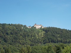
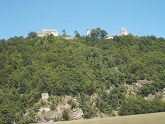
After that 30 km section things improved again and the section around Danube Bend was fantastic. Just bikes. Lots of bikes. And hills rising up from the river, like the Wye Valley bit on a much big scale and loads of places to stop for drinks or food. Und Schlösser. I also happened upon a Czech couple who had a flat tyre and were lacking a bike pump, so rescused them.


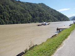
Just before Linz I took a ferry to cross the river, although I had to wait for the ferry to return from the other bank. Waiting made me realise how hot it was, and later I say a sign saying 28 °C and that was 4.30ish. At least a lot of today was in shade of trees, and it would get hotter as I headed further south.


I stayed on a great campsite just beyond Mauthausen (infamous for the Mauthausen-Gusen Concentration Camp, which I didn’t visit), after having raided a supermarket for food for the next day as there would be little open on a Sunday.

Day 6: Mauthausen to Vienna Route on Ride with GPS
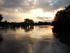
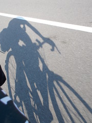
I thought I was ready to go at 7 am, until the valve on the front inner tube failed when I tried to pump up the tyre. After fitting a new inner tube I was off just after 7 am and shared the river path with a speed skater. The early mornings are a stunning time to ride because the world is pretty empty, the shadows are long and everything is peaceful.
   
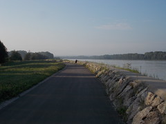
Flooding is clearly an issue in some parts of the area as massive floodwalls were in place in some areas, along with the height of the floodwaters in 2002. The roads are open, but it would seem that concrete blocks are dropped into place when there is a flood warning.

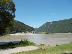
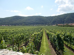
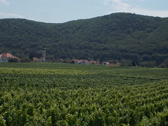
I had another ferry crossing, where I chatted with an American women, who worked in London but lived in the Black Forest and was married to a Dutch guy. During the day the scenery changed from narrow gorges, to open plans and vineyards.


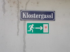
Safety is clearly an issue in Dürnstein!


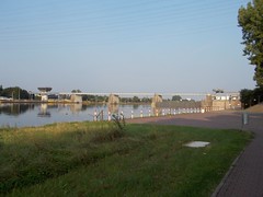
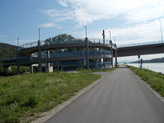
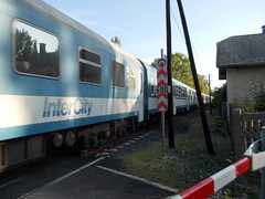
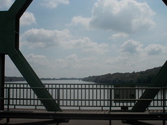
Getting on the bridges to cross the river can be, erm, interesting:


Somewhere around Tulln an der Donau I meet an Austria student who was out for 60 km ride. We rode along for another 15 km chatting away and successfully avoiding getting wet. I was offered accommodation, but decided to press on to Vienna as I didn’t want to make my next day any longer than the planned 230 km. Then on the approach to Vienna I ended up talking with a Romanian guy who been on the road for about four months and was slowly heading back to Romania.

Entering Vienna was easy as I rode down the Donauinsel, although I was still trying to dodge the rain. Clearly the lady in her 20s on a mountain bike and flat pedals was trying to do the same because I couldn’t drop her despite us riding at approximately 30 kph. I commented on how fast she was as I turned off for the Neue Donau campsite (not recommended as the camping here felt grubby and the site is situated between motorways and train lines). The rain I had been trying to avoid eventually hit Vienna around 9 pm with an amazing thunderstorm.

Day 7: Vienna to Balatonalmádi (Hungary) Route on Ride with GPS

This morning I left the Danube behind, which felt strange having ridden along the river for the past few days. We will be briefly united in Hungary and Serbia. I rode out of Vienna via the dockland area and the airport, which was clearly signed, which impressed me a lot.


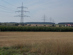
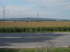
After that I climbed over a small hill, which after the last few days was a welcome novelty, and then dropped down to the Neusiedler See, surrounding which is a vast area of agricultural land that is not dissimilar to the fens. I was delighted to discover I had a tailwind.

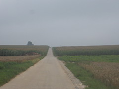
I then entered Hungary, which was a moment of celebration as it meant another country closer to Greece, although the only thing to note I was now in Hungary was a road sign as I was still in the flat lands and on loooooooooong straight roads. There was far less detail on the wikimap I’d put onto my Garmin compared to Austria etc. This meant any feature, eg a road junction, was something to aim for to break up the boredom. There were some people cycling in the villages, but I only saw one recreational cyclist all day, which is in contrast to the last few days.

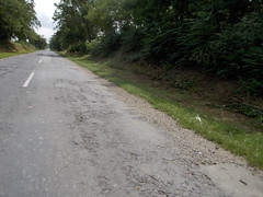
Initially my road was a single carriageway main road that was full of lorries. There was no alternative, so I just had to suck it up, as did the locals I saw. At least the tail wind helped to get that 10 km done with quicker. Turning off that road put me onto rubbish surfaces and tarmac had appeared to have been thrown at the road in the hope it'd become flat. It was mentally tough going as I constantly had to pick out the best route through the holes. The towns felt a bit rundown, but the one good thing was the drinking fountains that came in useful as the temperature was increasing. It felt very "east".


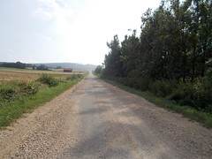
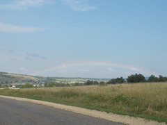
Near to Lake Balaton I entered woodlands and hills. The roads were still rubbish, and in some parts covered in gravel, but there were very few cars, and it was beautiful scenery. I slowly climbed the hills and even saw a rainbow, which was very pretty.


Then the final 30 km were all downhill, but the only problem was the dual carriageway on which cycling was prohibited, which was sensible because there was no hard shoulder. However, avoiding this road would have meant riding an extra 40 or so kilometres. Hmm. I slowly set off down the gravel verge of the dual carriageway and then found a track through some fields, so I slowly bounced along the track. I wasn't impressed, but it was only for a kilometre or so before I hit tarmac again. After fighting my way through Veszprém I arrived at Balatonalmádi alive, so went for a swim in the lake to relax after a long day and contemplate what the following day would have in store for me. I predicted busy roads, rubbish roads, flatness, heat and boredom.


Day 8: Balatonalmádi to Szeged Route on Ride with GPS

I set off from Balatonalmádi in the glorious morning light. The best parts of each day seem to be those early morning hours when the world was still quiet, the shadows still long and the coolness something to savour. There is a route right around Lake Balaton, which is something I've also fancied doing in a day, but today I just rode a few kilometres, enjoying the views across the lake and seeing the old fashioned train that runs up to Budapest:

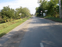
All too soon I left the lake behind and then was back onto busy roads (Route 64) or badly surfaced roads, such as this example:


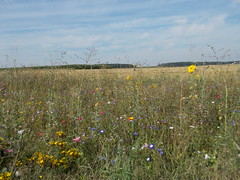
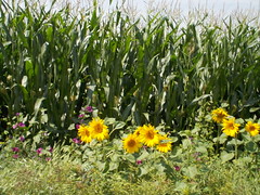
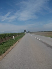
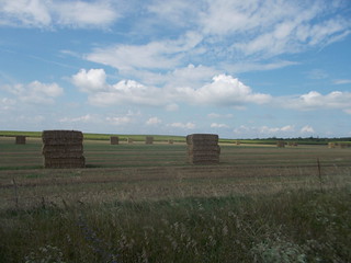
However, after a bit I was cycling through picturesque fields with fluffy clouds and artistically arranged haybales. And sweetcorn, of couse, because everywhere in Europe seems to grow sweetcorn! The roads were very much still straight. To infinite and beyond.


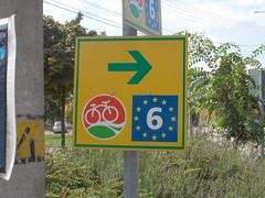
The next mental checkpoint for the day was Dunaföldvár as this would be where I'd get to see my old friend, the Danube River. It felt strangely comforting to see the river again, and also the signposts for the EuroVelo 6, which is the cycle route down the Danube, although this time our paths were merely crossing.

After Solt I was on more busy roads and while the flat topography and well surfaced road meant I could make quick progress, I did have to put up with a huge amount of traffic. In Kiskőrös I stopped at a water fountain to refill the bibons, whereupon a Hungarian couple started asking me about my trip as they had also done some cycle touring. Looking back on things I realise I should have taken photos of the people I meet on the roadside, but at the time was just grateful for the converstation. At least after Kiskőrös there was a cyclepath, which gave me some peace from the lorries and at Soltvadkert I turned off the mainroad. Yay! However, my joy was short-lived when I realised my nice quiet road was so badly surfaced doing 20 kph was basically impossible as I was being shaken all over the bike. My wrists hurt from trying to control the bike, and this went on for about 50 km. To help I sent some rude messages back to Pippa in the UK and loudly cursed the road. It didn't help. So I stopped for a break in Csólyospálos, bought some food and got given a free expresso, so suddenly the kindness of people made things seem better. I set off for the final 30 km of the day in a better mood, and managed to arrive at my friend's flat ten minutes after a massive thunderstorm hit Szeged. At least I wasn't putting up my tent tonight!

Day 9: Rest day

I spent the day in Szeged enjoying an easy day of eating, stocking up on some things like batteries and taking things easy. Distance wise I was about halfway to Greece, and I knew the distances I would be covering each day could now start to decrease.
What on earth am I doing here on this beautiful day?! This is the only life I've got!!

https://tyredandhungry.wordpress.com/

αdαmsκι

  • Instagram @ucfaaay Strava @ucfaaay
  • Look haggard. It sells.
Re: Solo Brussels - Kefalonia 3 week tour (warning - lots of photos)
« Reply #2 on: 04 September, 2014, 10:42:32 pm »
Part 2: Serbia to Albania

Day 10: Szeged to Šabac (Serbia) Route on Ride with GPS

Today I would leave the EU and head into territories that, to me, would be new. However, first I had to enter Serbia, which wasn't a foregone conclusion because I hadn't been able to get a definite answer about whether I, as a non-Hungarian or Serbian citizen, could use the border crossing between Tiszasziget and Đala. The early morning ride down to Tiszasziget passed through some pretty villages, and perhaps because I was leaving Hungary I was granted a quiet road with a good surface. Signs were appearing for the border crossing.

In the end the border crossing wasn't an issue, and as it is only a small road leading to this border post I crossed really quickly. The only thing that did raise an eyebrow was my response to the friendly question “Where go?” from the Serbian border guard. She clearly didn't expect the answer to be “Greece”! I sent a few messages using the last of the Hungarian 3g phone signal and then set off into this new land, where the roadsigns had funny letters and goats were tied up outside houses.


However, the first part of Serbia contains a lot of Hungarians, so signs are in Serbian, Hungarian and English. In the bakery everyone was speaking Hungarian, which meant I was able to use the few words of Hungarian I know. Just to make things feel even more Hungarian I re-crossed the River Tisza, which I had left behind in Szeged.

From Đala I had about 100 km to cover across the Serbian flatlands to reach Novi Sad, and to be honest I don't remember too much about this part of the trip. The roads were better surfaced than in Hungary, there wasn't too much traffic, I got plenty of space from the traffic and the road were of the long, straight, variety. I don't even have any photographs. Anyway, I reached Novi Sad and again crossed the Danube River, although this would be my final sighting of this great waterway.

After Novi Sad I knew I had a bit of a climb across the Fruška Gora mountains, which I was looking forward to as a change from the flatlands I had been cycling through. I knew the climb went up to 420 m, so at the bottom of the climb I switched the Garmin to display my elevation and set off up the hill. It was a beautiful climb, initially past some fancy houses and then through beautiful woodland. There were steep sections, (>10 %), but also switchbacks in parts so it was difficult to find a rhythm, but still very enjoyable. At the summit I took a break, and then set off down to Šabac, passing through more flatlands.

The final 30 km into Šabac were along a pretty busy, and not very pleasant, main road. Perhaps riding it at around 4 pm didn't help, but still I just put my head down and got on with the job. A WarmShowers host had offered my accommodation in Šabac, but hadn't confirmed where and how I would find him, so I headed into the city centre to think about my options. I timed my arrival perfectly because as I rolled into Šabac I looked down a street to see a wall of rain heading towards me and people diving for cover. I hid under the unbrellas of the first cafe I saw and helped the waiters grab cushions etc. so they didn't get soaked.

I knew my WarmShowers host ran a bike shop, and his profile gave an address, but it wasn't clear if that was the shop or his house. Plus I didn't have a map so couldn't easily find the shop. However, after trying to look at the map on my Garmin I discovered the Etrex 20 could navigate to an address, so I plugged in the details from the WarmShowers website and 800 m later I was sat in a bike shop drinking beer. Result! I then got taken out for some food, which I wasn't allowed to pay for, meet his family, and was then driven up to my host's deceased mother's house. This is also used as storage for bikes that aren't in his shop, so I had to be careful walking around the place. After a shower and cleaning my clothes I hit the hay, trying not to think too much about the provenance of all the bikes in the house.


Day 11: Šabac to Užice Route on Ride with GPS

I returned to the bike shop, meet one of the mechanics from the shop, had breakfast and food for the road bought for me and after a few photos I was off to Užice. I was very grateful for all the hospitality I had received in Šabac.

A few kilometres out of Šabac it started to rain and I had to stop to put on my waterproof and ensure my luggage wouldn't get wet. Somehow having to do this right at the start of the day is particular depressing, which is probably because it suggests the rest of the day will be spent riding through the ride. In the end that wasn't to be the case, but I didn't know that at the time. I set off again along some pretty some roads as I wanted to avoid the main road for as long as possible. The views were good, but would have been better without the cloud. The roads weren't great, but I could manage.

I was apprehensive when I picked up the main road again as this was the same road that I hadn't enjoyed yesterday, but this section was much better as the volume of traffic was far lower. In Hungary I would see the occasion Trabant, but in Serbia I was noticing a lot of old cars still in use, which I assume is a reflection of Hungary being a richer country than Serbia.

After Valjevo I knew I had three big climbs, so set off into the hills. The first climb followed the main road, so was well graded, on a good surface and very pleasant. Annoyingly the surface on the downhill sections wasn't anywhere near as good. Boo! However, to was good to be in the hills. About 30 km from Užice I left the main road to follow a shorter, but hillier, route. There was another climb up to 770 m, which was stunning. I seemed to be following the old main road that no one seems to know use apart from a few motorbike tourists. The views of the hills were fantastic & it was a lovely gradient to ride with many switch backs. However the surface was destroyed with large parts of gravel, but as I was climbing it wasn't an issue and the views were stunning.


The descent was better surfaced, but crazy. One section that sticks in my memory was steep, with switchback followed a few meters letter by another switchback (as you can clearly see on Google maps!). I was getting worried as I was constantly on the brakes, so the rims were just getting hotter and hotter. However, just as I was about to stop to allow the wheels to cool down that section ended. In Užice I received more wonderful Serbian hospitality via WarmShowers. My hosts rent out a little studio apartment and as the guy who rents the place was away I got the place to myself. The views were good.

I had a very enjoyable evening with my hosts, who took me out for dinner and beers. Again I couldn't pay for a thing. Incredible. Thanks!

Day 12: Užice to Mojkovac (Montenegro) Route on Ride with GPS

Despite only having been in Serbia for two days it was time to leave. I'd had a good time and would be happy to cycle here again in the future, but I still had over 100 km before I would enter Montenegro. The first part of the day was uphill, initally with fabuolus views of Užice, which is set in a bowl surrounded by hills. It was very pretty, but the road was very busy for about the first 10 km. Once up to about 1000 m the road bounced along, with lots climbs and descents of around 100 – 150 meters, which meant it was very difficult to get into a rhythm. However, the scenery was stunning and not dissimilar in parts to the Scottish highlands with open land, streams, pine trees and Zlatar Lake.

After that section I had a massive downhill (weeeee) to drop down to the Lim River, which I then followed upstream to the Montenegro border.  Surrounding the river were big hills. The road was busy with lots of Serbians heading to the beach, but the drivers were very friendly, waving or beeping their horns in encouragement as they overtook. One family slowed down and asked me where I was going and we travelled along chatting through their open window. Before the border the valley become narrowed into a gorge, with overhanging rocks and sheer mountains.

The border was reached and I got more stamps in my passport. It is a strange place because there is about 5 km difference between Serbian check point and Montenegro check point and I was wondering if I had somehow missed the Montenegro checkpoint.

The final climb of the day was very hot and I had to stop at roadside stall to cool down. I set off again and saw my first cycle tourists since Lake Balaton, in Hungary. They were stopped at the side of the road, so I pulled over to chat. They were a Swiss couple and were heading in the same direction, so we rode together. It was really good to ride with someone else for a change. We dropped into Mojkovac where we hoped to find campsite, but couldn't find anything, despite asking various people and being sent on various wild goose chases. Eventually we asked someone and she told us just to camp in her garden, so that is what we did. The view of the surrounding hills in the evening glow was lovely. We made up our tuna salad & Greek salads for dinner, ate, chatted & were then given coffee & schnapps by out hosts. An excellent day, capped by the sociable finish.


Day 13: Mojkovac to Barbullush (Albania) Route on Ride with GPS

I woke up to cloud at 1000 m and it was cold. My plan for the day was to follow the Tara River, which is meant to be stunning, but that seemed pointless as I wouldn't see anything and I also didn't want to climb up to 1,500 m as that would just mean more climb, so instead I rode out of the hills and down to Podgorica. The first hour of riding was cold, so I had to wear my warm & knee warmers, which did at least mean they got used on my trip and weren't carried for no reason. It would have been miserable at 1500 m. After crossing a col the sun appeared and the road down into Podgorica was very impressive as it dropped through narrow valleys, tunnels, bridges, past step cliffs and high above the river to lose 1,000 m in elevation. I kept stopping to take pictures. The tunnels were scary, especially if you forget to remove sunglasses or the batteries in your light die. Both of those things happened only once! I'm sure the way I'd planned to travel would have been better, but not if you can't see anything, but leaving Montenegro after only one night means I will have to return at some point.

After Podgorica I headed towards the Albanian border via a minor road that paralleled the main road as I wanted to avoid the traffic. In the end that main road wasn't very busy, but my route had one car and views to die for. The road was paved, but bumpy and therefore descending was slow, but I wasn't in a rush. My only concern was the heat; it was roasting.

There was a massive queue at the Montenegro checkpoint, so I cheekily rode to the front. I felt better when a Swiss couple on a motorbike did the same thing. The Swiss guy was impressed by my lack of luggage, but he did point that was to be expected without a tent etc. He was even more impressed when he realised I was camping, and had ridden from Belgium with that little stuff.

The road in Albania was wide, well surfaced and with a large hard shoulder to ride in, so I had no issues with traffic, especially as some was of the horse and cart variety. The only issue was the heat, but lots of water helped, and it wasn't so bad that I felt like I needed to stop. The views of the mountains from the road were impressive.


After Shkodër the road become busy and I was relieved when I reached Camping Albania, which is campsite run by a Dutch family who moved out here years ago and have done a lot of charity work in the area. The site was like an oasis, with WiFi, a bar, restaurant, swimming pool, and shade from the sun. It seemed like a good place for a restday, so I chose to stay two nights.


Day 14: Barbullush to Barbullush Route on Ride with GPS

Today was spent relaxing. I finished reading my book, used the swimming pool, enjoyed a leisurely breakfast, used the WiFi to look for campsites in Greece and did a 15 km ride around the local area.
What on earth am I doing here on this beautiful day?! This is the only life I've got!!

https://tyredandhungry.wordpress.com/

αdαmsκι

  • Instagram @ucfaaay Strava @ucfaaay
  • Look haggard. It sells.
Re: Solo Brussels - Kefalonia 3 week tour (warning - lots of photos)
« Reply #3 on: 04 September, 2014, 10:50:24 pm »
Part 3: Almost there
Day 15: Barbullush to Tirana Route on Ride with GPS

I left my little Dutch oasis before 7 am in order to cover as much distance as possible before it got too hot. The sunrise was stunning and made getting up early worthwhile. The old communist factories are very photogenic too.


Unfortunately, after Milot things deteriorated. I had decided not to ride the main highway down to Tirana because other cyclists experiences said it was very busy, so instead was following a parallel road. After Milot this road turned into a track. I ended up riding a lot of it at not much more than walking pace, but I did see a lot of Albanian life. The kid on a donkey with granddad moving the goats and cows. The two guys who'd managed to get their lorry stuck in some mud. The son and mum (or grandmum?) who were busy picking blackberries. The kids sitting in the field under a tree to hide from the heat. And a tortoise, although he kept hiding in his shell.


Riding in the Albanian towns is an interesting experience. I guess when I arrived into Albania I didnt get a proper experience because it was a Sunday. Today I did, and not just in Tirana, but everywhere. Drivers using their mobile phone to send text messages or make phone calls. Drivers pulling out without even a vague look. People overtaking aggressively and then stopping 20 m down the road for a chat with someone. Horns being constantly beeped for whatever reason (most of the time I had no clue!). People crossing the road without looking. People with goats crossing the road.... However, I made it to the Tirana Backpacker hostel in one piece and spent the afternoon exploring Tirana, including a walking tour of the city, which gave me some understanding of the history of Albania.


Day 16: Tirana to Berat Route on Ride with GPS

First, the positives from today. I set off early to avoid some of the heat of the day, and also so I could do the climb from Tirana up to 800 m before the temperatures became bonkers. The climb was magical as the road was empty, the views interesting and it wasn't a particularly difficult climb, just long. At the top the road contour around the top of the hill to give some spectular views.

Before arriving in Kuçovë there was a fantastic section of road along a valley and then a short climb. I passed through farming villages and saw nodding donkeys being used for oil extraction. 


However, the negatives from the ride outweighed the positves. Firstly, I hadn't been mentally prepared for the poverty in Albania. Seeing kids begging in the streets is something I've seen in Delhi and Lahore, but isn't expected in Europe. The same goes for seeing cows walking the streets and eating rubbish. I expected Albania to be bit poorer than Serbia, but the difference was massive. Secondly, lots of the roads were basically tracks, but with a lot of traffic and I didn't enjoy slowly bouncing along a gravel track that is marked as a fairly major road. (Nor did I appreciate  falling off when a car unexpectedly stopped to navigate a particularlly deep pothole and I had a clipless moment.) Also, I got stung by something, resulting in my shoulder going numb and I had to stop at the edge of the road and strip off my jersey to allow the bug to escape. This happened to be in front of an old couple, who were clearly shocked and confused.


The afternoon was spent exploring Berat, which was beautiful and helped to improve my mood. Plus I planned to escape Albania the following day I had 150 km to ride to get to to Sarandë, from where I would catch the ferry to Corfu. I knew the last ferry of the day was at 4 pm, but was optimistic that was achievable.


Day 17: Berat to Sarandë Himarë Route on Ride with GPS

Today I was aiming to ride to Sarandë, via Gjirokastër, and then take the ferry to Corfu, so I set off just after 6 am and was rewarded with a fabulous sunrise of Berat. I knew I had a massive climb, and it began immediately, but it was beautiful cycling through the woods. However, after 2 km the road turned into a gravel road. After another kilometer or so I gave up hope of tarmac reappearing and turned around, which meant 40 minutes or so later I was back where I'd started. My planned route clearly wouldn't work and I needed to figure out how to get to Sarandë. One choice was the 8 am bus, which would mean I could still make the ferry and not have to spend another night in Albania. However, the combution of worry about what would happen to the bike and my only feeling that I would have somehow failed. So instead I bought a road map in petrol stations (which, along with car washes, seem to the the mainstay of the Albania economy!) and made a new plan. Sarandë is south of Berat, but to get there I'd have to go north to Fier and then follow the coastroad. Although this is a coastroad that goes over the Llogara Pass, which is only slighly lower than the highest point in England and Wales.

So I set off for Fier, cursed the road (dull countryside and a rubbish road, which was followed by a gravel track). Laughed at a weird ship shapped house and then smiled when tarmac reappeared, before realising that the tarmac was heading away from Fier. An Albania guy explained that the tarmaced road would take me to Fier, so I set off and discovered it went via a stinky polluted petrochemical working area. It's good to see different parts of Albania....

In Fier I saw my first cyclotourist since Montenegro, so I stopped and chatted. I was told the coast road from Vlores was tarmac – yay!. I set off again, ended up riding down a motorway access road / track by mistake before finding the parallel road. It was dull & poorly surfaced. Surprise surprise. Tho, wow another cyclo tourist. They must be like buses.


Albania is covered concrete bunkers that were built during the Commuist era. Cycling around the country meant I kept coming across these relics from that era.


I reached Vlores, diced with the traffic and was then on the SH8, the coast highway. Along with every other car in Albania, although there were so many I was moving faster. Eventually the cars and their owners found parking spots so they could cook themselves on the beach. I carried on and turned into the valley I'd follow up to >1,000 m. There was a massive headwind blowing, so I took a siesta and admired the tumbleweed. Once awake again the heat seemed less. The wind reminded. Great. The climb was hard, lots of >10% bits and a lot had to be climbed out of the saddle in my lowest gear, but at least I didn't overheat unlike a number of cars. Upon reaching the top the vista was amazing as suddenly I could see the blue sea way below me and mountains everywhere. Albania suddenly looked very pretty. The descent was a lot less steep, so I could let the bike roll and not hang onto the brakes, but at the same time remembering this is Albania and around any bend could be potholes, gravel, goats etc.


Once at the bottom of the hill the road bounced along between 200 & 300 m, with more bits of 10%. Ouch. But more stunning views. Albania can very attractive. I think you just need to know where to ride, although saying that I still saw kids rummaging in the local dump, so those contrasts still remain (and this is about 40 miles from an EU country...). Anyway, I made it to Himarë where I camped for the night.


Day 18: Himarë to Sarandë, followed by the ferry to Corfu (Greece) Route to Sarandë on Ride with GPS and Route on Corfu on Ride with GPS

The ride along the coast from Himarë was spectacular. Turquoise seas, mountains and a constantly twisting and undulating road. It wasn't that busy and well surfaced. I got some “driving music” on my iPod and had a great time. Just as I am leaving Albania I am starting to understand why people come on cycling holidays in Albania.

I got to Sarandë around noon, had lunch and sat about in the shade, ignoring the kids begging, until the boat left at 4 pm. The trip was lovely with views across the sea to various islands, and also of a forest fire. I had been expecting something a bit bigger than a boat that could only take a few cars, but it worked.

I then rode a few kilometres to a campsite and was amazed at how ordered everything seemed to be compared to Albania, but it was all Greek to me!

My aim for the trip had been to cycle to Greece, which I had now achieved and that felt amazing. Reflecting on the trip allowed me to realise what amazing things I had seen on this trip, but I still need to get to Kefalonia for my flight home.
What on earth am I doing here on this beautiful day?! This is the only life I've got!!

https://tyredandhungry.wordpress.com/

αdαmsκι

  • Instagram @ucfaaay Strava @ucfaaay
  • Look haggard. It sells.
Re: Solo Brussels - Kefalonia 3 week tour (warning - lots of photos)
« Reply #4 on: 04 September, 2014, 10:52:49 pm »
Part 4: Greece!

Day 19: Limni to Lefkimmi, ferry to Igoumenitsa and then 85 km ride to Ligia Route on Corfu on Ride with GPS and Route down the mainland on Ride with GPS
The 50 km ride across Corfu was powered by the finest bakery products available in the first bakery I passed on route, which was after about ½ km. No more cheap, plasticy, 7Days croissants that were what I'd been buying in The Balkans. Oh no, not now I was somewhere civilised. The fine bakery products provided the perfect pacing and I arrived in Lefkimmi minutes before the ferry departed.


After a pleasant ferry journey I was nearing the mainland. I had planned to follow the E55, but as I had plenty of time decided to stick more to the coast and go via Syvota and Parga, which would be longer and hillier, but hopefully more interesting. It was certainly hilly, with the road rising up to nearly 400 m. When climbing I could see the sun cream being washed out of my pores due to the amount of sweat I was producing. Nice. The road was certainly beautiful and any view could have been placed onto a postcard. I stopped in Parga for lunch and enjoyed the shade for a while.


I then re-joined the main road, admired the views across the Acheron river delta and then flogged up the hill on the other side. The climb was the long, straight and of a constant gradient, so boring, and seemingly never ending. The descent back to the sea was sinuous, bumpy and fun. I then road along the along coast road and I was hoping there would be a campsite somewhere as for once I hadn't checked in advance. It was a strange feeling of not knowing how far I would have to ride until I would find somewhere to stay for the night, but I did find a good site for the night. As the campsite was right next to the sea I had to go swimming once I had erected my home.


Day 20: Ligia to Vasiliki, ferry to Fiskardo and then 40 km to Sami Route to Vasiliki on Ride with GPS and Route across Kefalonia on Ride with GPS

My flight home was booked from Kefalonia, which was my destination for today. Another early start meant a glorious sunrise and the enjoyment of cool temperatures. The only other people out were also running or walking in the cool morning. More stunning views as well.


My first worry of the day was the Preveza- Aktion tunnel. Cycling is banned in the tunnel and it is 140 km route to avoid the tunnel. I'd read there was a service for cyclists, but when I got to the entrance there was nothing obvious, and a local man was very insistent I wasn't to attempt to cycle through the tunnel. There was a CCTV camera, so I smiled, pointed at my bike & then the tunnel. Two minutes later a yellow flatbed pick up arrived, my bike was dumped in the back, the driver and I chatted and I was through the tunnel. It is a toll tunnel, but free for bikes. The Dartford crossing service is no longer 24/7. We in the UK could learn a lot.

The ride from there to ferry was great. I saw a house on a tiny island, which I assumed was a hermitage. I went across the causeway onto Lefakada, which was beautiful. The towns are touristy, but not built up so still feel pleasant. The ferry gave views of the islands and then I was on Kefalonia. Whoop. I had made it, although I still needed to reach Argostoli, which is the main town. Shame I couldn't stay on one of the super-yachts.


I had planned to ride to Argostoli, but there were road divisions in place, for reasons unknown. I dutifully followed the divisions and ended up climbing to 620 m, which was rather unexpected! I then was sent back down to sea level, but was now on the wrong side of the island and the signs to Argostoli pointed me back over another 600 m hill. It was very windy (going downhill meant either pedalling to do 20 kph or getting scared by my speed, depending on the direction of the road) & already 4 pm. I was in no rush, so found a campsite in Sami that was just a few km away, went swimming in the sea and then walked into town for a beer. Everything was beautiful.


Day 21: Sami to Argostoli Route on Ride with GPS

Today I would reach Argostoli, which would be the end of the tour and from where I would fly home. Sami to Argostoli is less than 30 km and I had all day, so decided to cycle there via the southern part of Kefalonia. The day started by climbing to over 500 m. It was difficult to tell how the road would escape the valley as there was no obvious route, but it managed and the reward was views out to sea, a drinking fountain and a decent back down to sea level.
I am a bit browner then a few weeks ago.
I followed the coast, with a few undulations thrown in for good measure. All the time I was riding along in awe of the scenery. This was another road that requried driving music, so I put the iPod on and sang along to myself.


Kefalonia seems to be good at making honey as there are lots of beehives.


I got to Argostoli, stopped at Ainos Bicycles to enquire about a bike box and was told to return the next day to pick up a box. Result. I then rode up to the campsite and once again went swimming. Touring in Greece is hard work! Tomorrow would be my final day.

Day 22: Argostoli to Lixouri Route on Ride with GPS

In the morning I walked back to Argostoli to collect my bike box and had breakfast in town. After removing the mudguards, Carradice and Carradice rack I rode around to Lixouri. I was looking forward to riding the bike without the luggage, but it actually felt really strange. It was another fabulous ride, with views across the bay back to Argostoli, quiet roads and a ferry ride back to town. All that was left to do was to pack the bike into the box; book a taxi to the airport and go to bed for the final night.
   
The flight back to London the next morning was straightforward and it seemed remarkably how quickly it was to return to the UK.
What on earth am I doing here on this beautiful day?! This is the only life I've got!!

https://tyredandhungry.wordpress.com/

αdαmsκι

  • Instagram @ucfaaay Strava @ucfaaay
  • Look haggard. It sells.
Re: Solo Brussels - Kefalonia 3 week tour (warning - lots of photos)
« Reply #5 on: 04 September, 2014, 10:54:55 pm »
Epilogue

This was the first time I had done a long cycle tour. Before I started I was a bit worried, but in the end everything went really well. Despite riding most of the route on my own I didn't find the trip particullary lonely, probably because I was interacting with people during the day and on campsites. The WarmShowers experiences were all fantastic and would be something I'd happily use again. I doubt I will do another long trip next year because of PBP, but would happily done another solo ten / fifteen day tour.

Kit list
For anyone interested the kit list is below:
(click to show/hide)
What on earth am I doing here on this beautiful day?! This is the only life I've got!!

https://tyredandhungry.wordpress.com/

Re: Solo Brussels - Kefalonia 3 week tour (warning - lots of photos)
« Reply #6 on: 23 September, 2014, 11:12:08 pm »
Really enjoyable read Adamski. What a ride!

Posts in this part of the forum tend to get missed - I only spotted this today.

Re: Solo Brussels - Kefalonia 3 week tour (warning - lots of photos)
« Reply #7 on: 24 September, 2014, 11:27:46 am »
What an adventure. Thanks for the write up.
Get a bicycle. You will never regret it, if you live- Mark Twain

Re: Solo Brussels - Kefalonia 3 week tour (warning - lots of photos)
« Reply #8 on: 24 September, 2014, 12:51:25 pm »
Reading more... I've only just cottoned on to your typical daily mileage. <Coff> It's a wonder you had time for any photos.

Pancho

  • لَا أَعْبُدُ مَا تَعْبُدُونَ
Re: Solo Brussels - Kefalonia 3 week tour (warning - lots of photos)
« Reply #9 on: 24 September, 2014, 06:45:43 pm »
Fantastic read - many thanks for posting. An inspiring ride - but at a hell of a daily mileage (by my standards).

Otto

  • Biking Bad
Re: Solo Brussels - Kefalonia 3 week tour (warning - lots of photos)
« Reply #10 on: 24 September, 2014, 09:26:33 pm »
Brilliant!

αdαmsκι

  • Instagram @ucfaaay Strava @ucfaaay
  • Look haggard. It sells.
Re: Solo Brussels - Kefalonia 3 week tour (warning - lots of photos)
« Reply #11 on: 24 September, 2014, 09:38:09 pm »
Reading more... I've only just cottoned on to your typical daily mileage. <Coff> It's a wonder you had time for any photos.

Would you expect anything less from me?!
What on earth am I doing here on this beautiful day?! This is the only life I've got!!

https://tyredandhungry.wordpress.com/

bloomers100

  • ACME's Head of Sexual Health and Family Planning
Re: Solo Brussels - Kefalonia 3 week tour (warning - lots of photos)
« Reply #12 on: 24 September, 2014, 10:27:54 pm »
I just found this too. Very inspiring, thanks for the effort made in writing it up.

Re: Solo Brussels - Kefalonia 3 week tour (warning - lots of photos)
« Reply #13 on: 24 September, 2014, 11:47:59 pm »
Would you expect anything less from me?!

You were meant to be on your hollibobs!

Adam

  • It'll soon be summer
    • Charity ride Durness to Dover 18-25th June 2011
Re: Solo Brussels - Kefalonia 3 week tour (warning - lots of photos)
« Reply #14 on: 26 September, 2014, 10:22:36 pm »
Epic.  :thumbsup:
“Life is like riding a bicycle. To keep your balance you must keep moving.” -Albert Einstein

Charlotte

  • Dissolute libertine
  • Here's to ol' D.H. Lawrence...
    • charlottebarnes.co.uk
Re: Solo Brussels - Kefalonia 3 week tour (warning - lots of photos)
« Reply #15 on: 26 September, 2014, 10:52:33 pm »
You were meant to be on your hollibobs!

'Eees a friggin' loony  :o

Great read Adamski - and much respect on a seriously audacious ride!
Commercial, Editorial and PR Photographer - www.charlottebarnes.co.uk

Riggers

  • Mine's a pipe, er… pint!
Re: Solo Brussels - Kefalonia 3 week tour (warning - lots of photos)
« Reply #16 on: 30 September, 2014, 12:25:12 pm »
Jolly nice read Adamers, and nice to see you list your kit. Very interesting indeed! Sounds like you had a very memorable ride. Well done Sir!
Certainly never seen cycling south of Sussex

spindrift

Re: Solo Brussels - Kefalonia 3 week tour (warning - lots of photos)
« Reply #17 on: 30 September, 2014, 01:59:11 pm »
I was in Lixouri for three weeks last year. It's great fun watching the ferry blokes load the vehicles onto the ferry. Great read, chapeau!

αdαmsκι

  • Instagram @ucfaaay Strava @ucfaaay
  • Look haggard. It sells.
Re: Solo Brussels - Kefalonia 3 week tour (warning - lots of photos)
« Reply #18 on: 30 September, 2014, 06:39:14 pm »
I was in Lixouri for three weeks last year. It's great fun watching the ferry blokes load the vehicles onto the ferry. Great read, chapeau!

Whereas I spent my time at the Argostoli campsite watching the Argostoli > Lixouri ferry plough back and forth.
What on earth am I doing here on this beautiful day?! This is the only life I've got!!

https://tyredandhungry.wordpress.com/

Martin 14

  • People too weak to follow their own dreams, will a
Re: Solo Brussels - Kefalonia 3 week tour (warning - lots of photos)
« Reply #19 on: 04 October, 2014, 01:13:41 pm »
Leg in plaster, it made the perfect Saturday read for me, inspiring!  :)
People too weak to follow their own dreams, will always find a way to discourage yours

αdαmsκι

  • Instagram @ucfaaay Strava @ucfaaay
  • Look haggard. It sells.
Re: Solo Brussels - Kefalonia 3 week tour (warning - lots of photos)
« Reply #20 on: 07 June, 2015, 01:00:29 pm »
If anyone is interested I've now put the tracklog from my Garmin onto a Google map that one can view here: click.
What on earth am I doing here on this beautiful day?! This is the only life I've got!!

https://tyredandhungry.wordpress.com/

Ruthie

  • Her Majester
Re: Solo Brussels - Kefalonia 3 week tour (warning - lots of photos)
« Reply #21 on: 25 July, 2015, 11:44:51 pm »
Lovely RR Adamski.
Milk please, no sugar.