Day 2 - Navia to somewhere in the middle of nowhere
This was where the ride proper starts. It was the Google streetview scenes from around here onward into Galicia that made me choose this part of the world. The combination of quiet country roads with challenging climbs seemed almost too good to be true. Of course, the extensive numbers of wind power turbines everywhere suggested a potential reason for why it is not more popular. Anyhow, I was about to find out.
The route planning and execution was via Ridewithgps, using OSM cycle mapping delivered onto my phone and Garmin GPS. I also made certain I had the end of each day ride as a waypoint on the Garmin, and I tried to sense check the Ridewithgps route selection using Google streetview. From the navigation front, I found the combination of RidewithGPS instructions verbally from the phone combined with the track on the Garmin was unbeatable and something I'd use again. The two together worked to remove all uncertainty from the instructions, while the Garmin track gave me the flexibility to confidently alter the route on the hoof, something I did more and more of as the week went on.
The streetview investigation meant that I had some questions about the quality of some of the areas but the elevation profile

where I basically ended up climbing then riding a ridge looked too good to pass up. After the first 20k of climb where 10% appeared to be the max gradient, I would spend the whole day in about a 200m bracket.
Time for the off.
The ride started moving up the river valley, again lucky with the weather with a light tailwind.

The roads again are perfect, empty and inviting

Fairly soon, though, the OSM bike map basis made itself felt
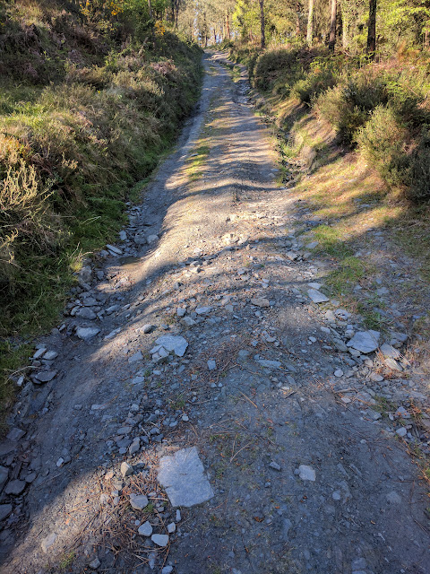
That's actually one of the better sections

- I was very happy at this stage to have the Croix de Fer with 38s which helped immensely. going through any of the water jumps, I chose the deeper tracks in the hope that the ground at the bottom was gravel not mud. that worked 98% of the time.
But , it was worth it, the proper road would never have got that high


This part of the ride was everything I'd hoped for.
This streetview shows where the track crossed the road, the view down both sides, and how streetview can fool you into thinking that the track is in good condition.
This day also took me into Galicia, in the province of Lugo, where the provincial roads are labeled LU-Pnn, eg LU-P501. This would be entirely unremarkable without the assitance of RidewithGPS directions, which said things like "Turn on to Loopy 501

I thought, they got it right.
Arrived at my hotel in the middle of nowhere all happy and fired up for the next day.
Here's the Re-live video[tbc]

