Well here is Phil science *
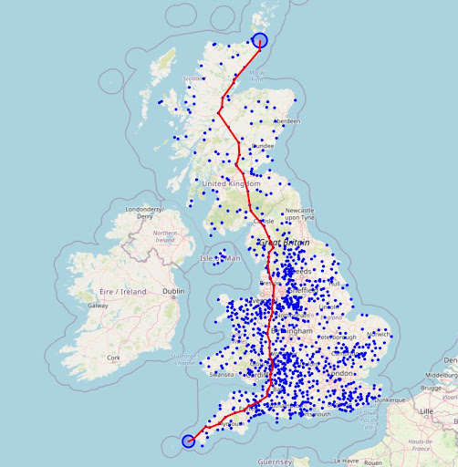
First iteration / test of shortest path routing. At the moment all routes lead to John O' Groats as I'm testing it routing across the country. The graph data set (I've built for routing) is very compact, at 200 kb, and it takes 18 milliseonds (1/50 second) to calculate a shortest route from Lands End to John 'O' Groats via the known permanent controls. It runs entirely in the browser, not needing a server back end to do the routing.
Note this won't tell you which roads to take but it will give a list of controls to move along, and it knows the Google walking distance between all controls, so can give you a minimum distance, plus a GPX with a list of control waypoints. When I write the later bit anyway.

York Arrow planning example

* Well actually it's Dijkstra's algorithm for the magic. I just generated the audax mesh weighted graph for it to consume. See
https://en.wikipedia.org/wiki/Dijkstra%27s_algorithm

