Nordkapp to KirkenesThe End of the Road II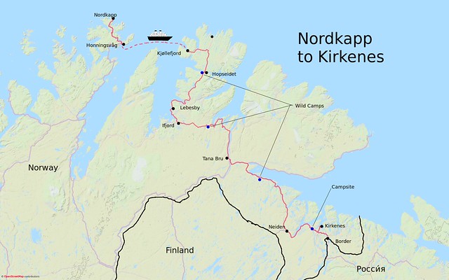
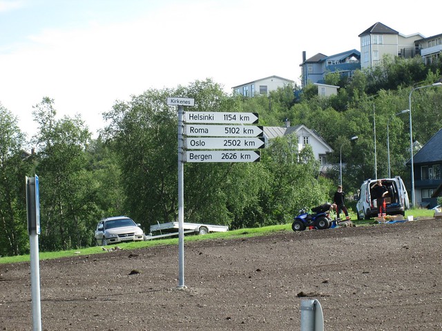
After Nordkapp, the next destination was Kirkenes. To get there I could retrace 130km or so to Olderfjord (including the tunnel), continue to Lachselv, then take the E6 or the E69 eastwards. Our I could take the Hurtigruten to the next peninsula along and avoid retracing.
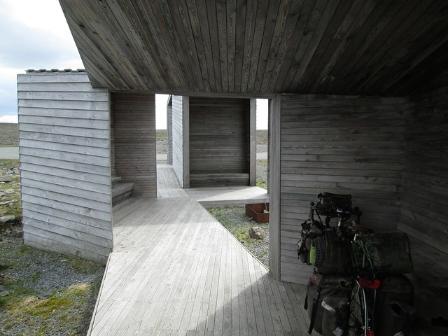
Whichever I chose, I had to retrace to Honningsvåg. Going back seemed a lot easier. Perhaps starting at 300m and ending at sea level had something to do with it. Not long after leaving the visitor centre I came to a small car park. This was for purists who wished to walk to Knivskelodden, the nearby point which is the northernmost point of Norway if you don't count Svalbard. From his blog I found that Oriol had done this. Here I met a French cyclist, Michel, who was also planning to hike there, having been thwarted by the fog and wind of the previous two days. He gave me the tip that the hostel at Honningsvåg was not much more expensive than the campsite, and included breakfast and use of washing machine.
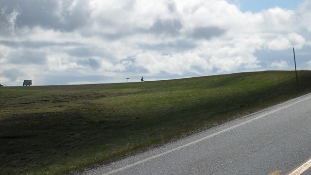
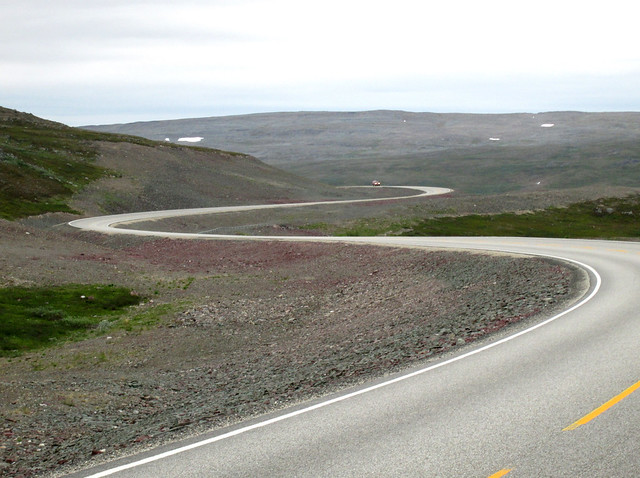
The road back to Honningsvåg:

A bit further on I passed a campsite advertising itself as the world's most northerly, and then met a young German cyclist, Ole. He wanted to know if I thought the campsite had a TV, because he wanted to watch that night's Euro 16 match involving Germany.
Ole on the horizon
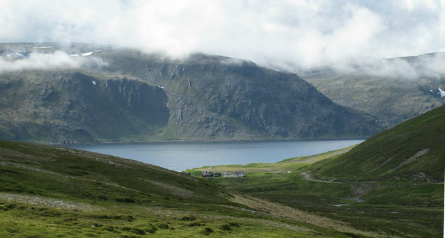
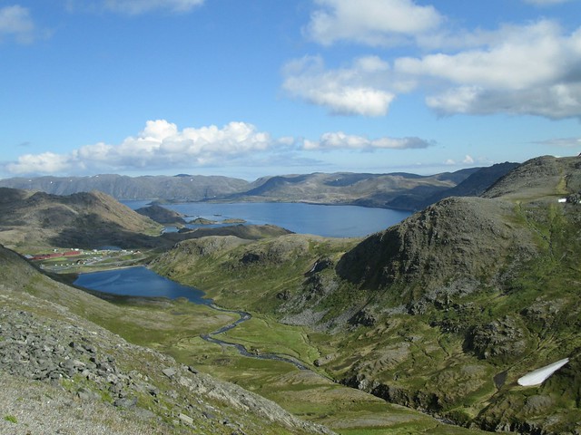
Just before Honningsvåg there is a long descent, but from the top there is a layby with a super view.
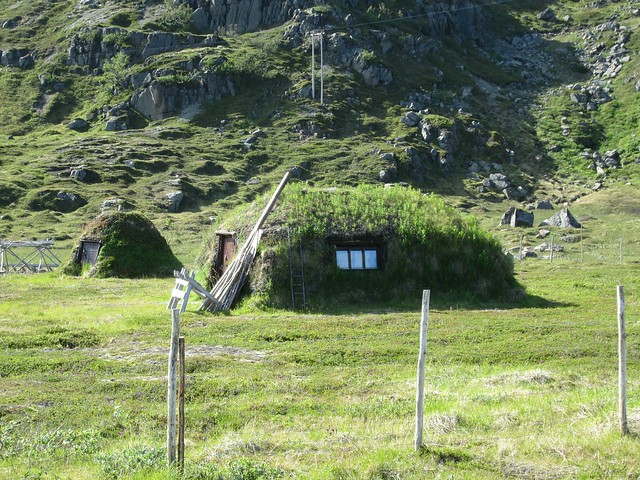
Traditional Sea Same houses near Honningsvåg
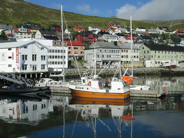
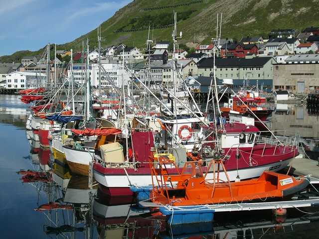
HonningsvågI reached Honningsvåg and booked into the hostel for a bargain 330kr. Ole had told me that the Rema2000 (a big supermarket chain) was open, despite it being Sunday and there being no hint of it being open on Sundays on the opening times, so I stocked up on the basis that you never ever ignore an open supermarket. I also booked a ticket for the next day's Hurtigruten ferry/cruise liner to the next port at Kjøllefjord.
In the hostel I met a New Zealander who intended to book a taxi to get back through the tunnel, and a Dutch motorcyclist who that evening gave up his hostel bed and rode up towards Nordkapp, pitching his tent on the tundra to enjoy the 24-hour sunshine. I was somewhat envious, and the following morning at breakfast he was enthusiastically showing everyone his photos.
I didn't sleep that much that night in the hostel, partly because of the bright sunshine all night, and partly because I stayed up late chatting with my German roommate. He had met a French cyclist called Jerome who had fishing tackle with him, and had caught a big fish of some sort, and distributed chunks of it to everyone he met. My roommate had a big piece which he went off to fry eventually, and was considering getting hold of a rod and line himself. In fact several of the cyclists I met had angling equipment with them, not something I myself had considered when packing.
The Hurtigruten wouldn't be leaving until the afternoon, so I had plenty of time the next morning. A little group of us sat outside the hostel in the warm sunshine, nearly all cyclists, but also including James, an Englishman, who had a bike but was just using it to get between hostels and airbnb bookings. He said he was spending a lot of time and effort finding accommodation and making bookings, and envied those of us with tents and our freedom to camp when and where we wanted.
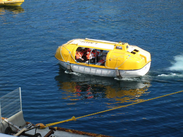
I had a leisurely stroll round the town, very pretty in the bright sunshine, had a snack, and made my way to the quai. The Hurtigruten stays a few hours in Honningsvåg to allow cruise passengers to be ferried by coach to Nordkapp. Today the departure was further delayed by a very leisurely practice evacuation.

Some of the crew enjoying a jolly round the harbour
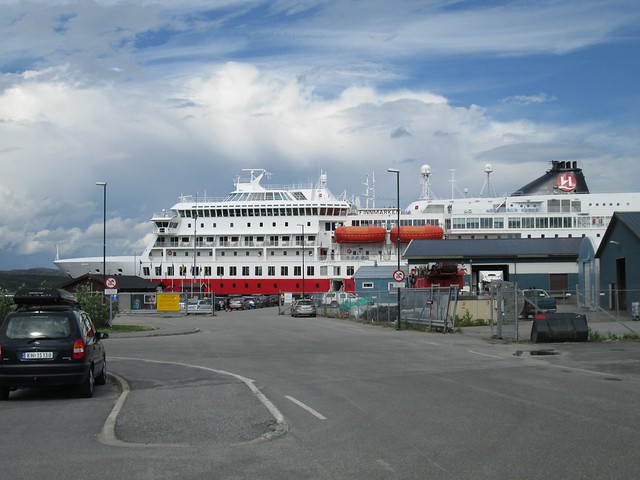
HurtigrutenOnce on board I made my way to the sun deck. Despite us being further north than pretty much all of Siberia and Alaska, cruise passengers were sunbathing and frolicking in the pool. A word of explanation of Hurtigruten - firstly it's a line of luxury cruise liners which go up and down the Norwegian coast between Bergen and Kirkenes, calling in at many ports in between and offering excursions. It can also be used as local transport so oiks like me can get on at one port and get off at the next.
Just as we were finally due to leave I saw a cyclist boarding, and recognised Ole, the young German I’d met on my way back from Nordkapp. It was a very relaxing couple of hours observing how the other half spent their holidays before we reached our destination at Kjøllefjord. I don't know how it compares with other cruise liners, but it was the poshest boat I've ever been on.
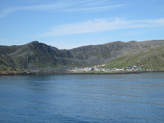
Kjøllefjord
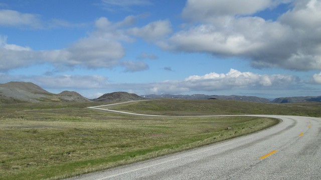
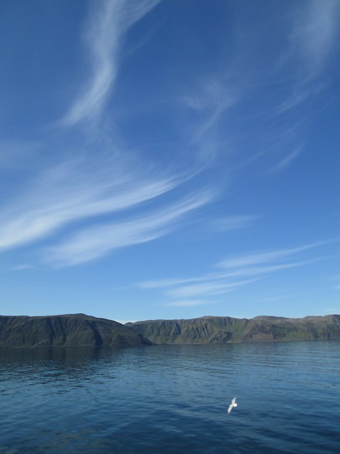
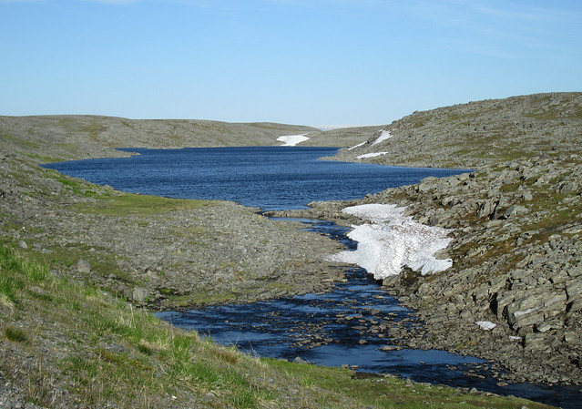
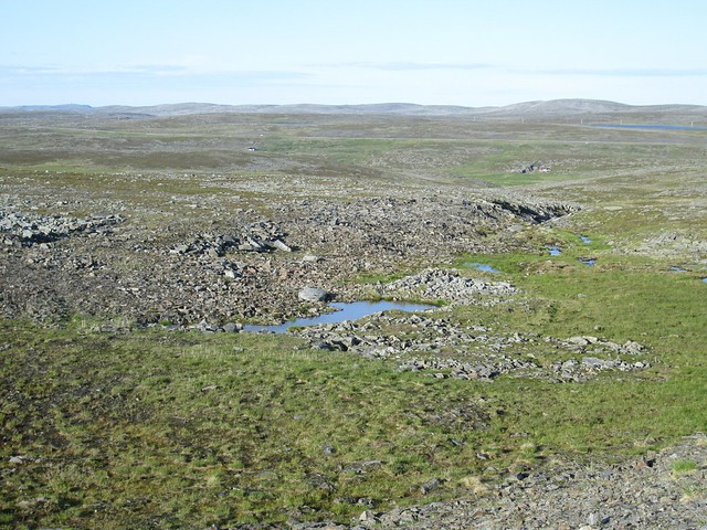
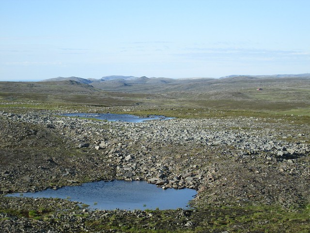
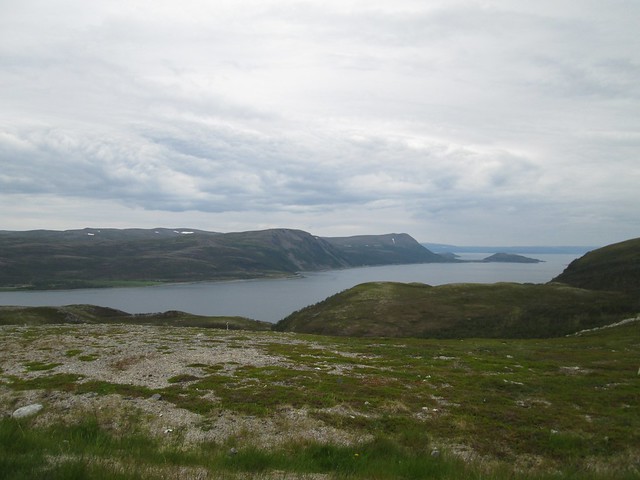
Across the Tundra.From Kjøllefjord we took the only road out, which immediately climbed to over 300m. Soon we were crossing a vast desolate landscape of arctic tundra. Just rocks, streams, boggy grass and patches of midsummer snow. No trees, no bushes, no buildings except one house near the only junction in 110km, no animals except small herds of reindeer. The sun was still out, but there was a fierce wind from the south, and at the junction with the road to Mehamn and the cape which is actually Norway/Europe’s most northerly mainland (which we declined to visit), we turned right into the teeth of the wind. We were making very slow progress, but the views and the sense of isolation were magnificent.
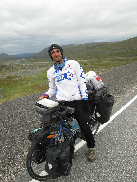
 Ole
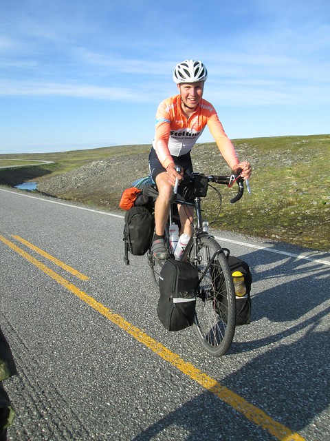
OleRiding with Ole was very refreshing. Only 18, he was taking advantage of the time between school and university. He wanted to study medicine, or failing that marine biology. It all depended on his exam results which would be published on June 30th. Today was the 27th. He kept mentioning different things he wanted to achieve in life, always wanting to stretch himself. In Tromsø he had run a marathon. When I was 18, I did my first multi day tour, four days from Lincolnshire to Galloway. I would have considered cycling to northern Norway much as I would have thought about riding to the moon.
Ole
Being a stripling less than a third of my age, eventually he found the going too slow, excused himself and rode off into the distance.
Ole disappearing into the distance
After slogging into the wind for 35km the road dropped back to sea level to cross Hopseidet, the isthmus which connects the northern half of the peninsula to the rest of the mainland. I was hoping to find somewhere to camp here - there had been no shelter on the high plateau. It was only when I had already begun the climb from the isthmus up towards the continuation of the plateau, that I heard someone shouting down below.
Hopseidet:
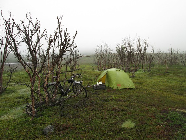
 Jungle
Ole had found a perfect spot for camping. I couldn't make out what he was shouting, but he was pointing back down the road, so I turned round. As I said, perfect, with one drawback. It was only reachable by fighting through about 30 metres of low, stunted but dense jungle. I unloaded my bike and we manhandled it over the barrier. Leaving my bike we carried my bags down to where he had pitched his tent. Apart from some small twisted trees and bushes, the undergrowth came up above my knees. Underfoot but invisible were jumbled rocks - my biggest fear was stumbling and twisting or breaking an ankle.
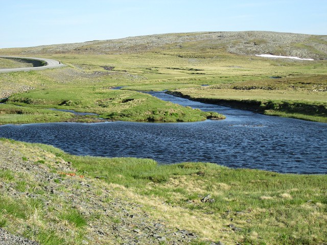
It really was a super place to camp. The ground was covered with some sort of low springy plant, there was a river flowing into the fjord for bathing and drinking water, and there was not a breath of wind. Incidentally the water in the river wasn’t too cold for bathing despite being recently melted snow. We guessed that on the plateau it flows through a series of shallow pools which would have been warmed in the sun.

After two nights with limited sleep, I slept like a log. The following morning I got up at my normal time about 7 a.m., made good use of the river and had my morning coffee. Ole stuck his head out of his tent and said he was going to sleep longer, so I packed everything up and started lugging my tent and bags up the slope to my bike. It took two return trips through the jungle. I hadn’t realised the previous evening that the jungle was home to evil biting insects. With both hands full I was unable to brush them off my bare legs, and by the time I’d got everything back to the road and on my bike, my lower legs were covered in blood. But my ankles weren’t broken.
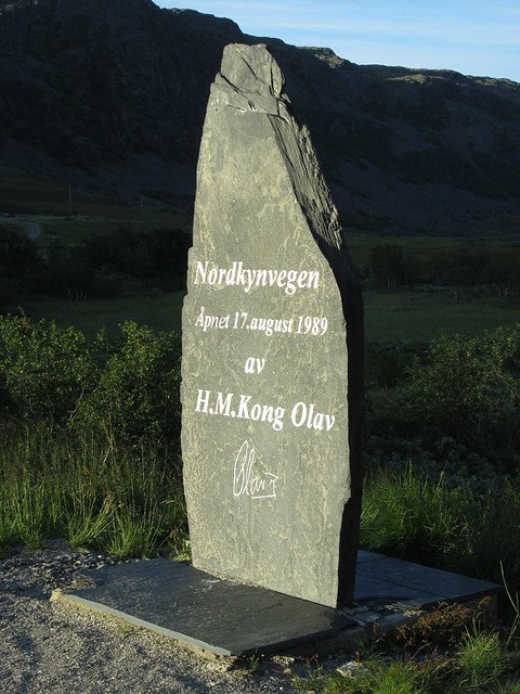
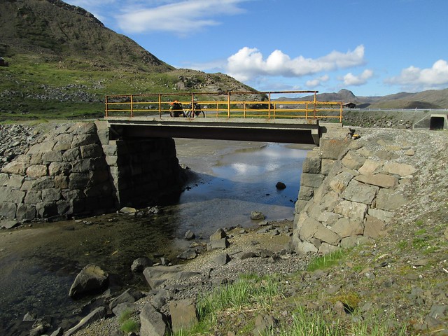
The road was opened in 1989
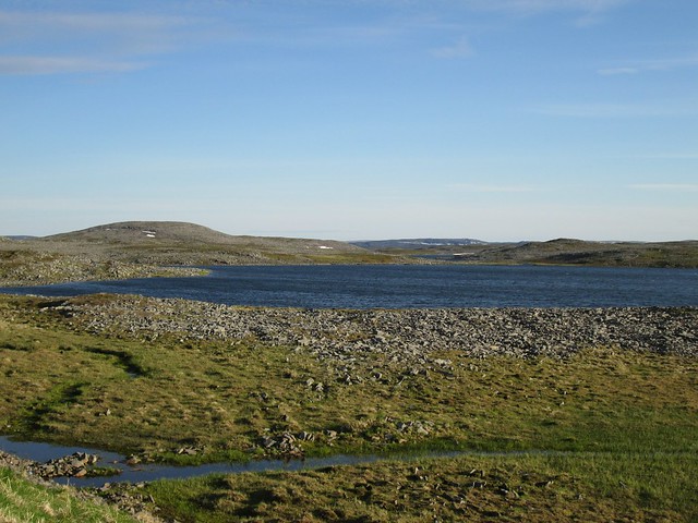
The climb took me back up over 300m to the plateau and an identical landscape to the previous evening. (BTW I see that I’m in the top 10 for the strava segment on this climb - 5th out of 5 at 6.2km/h.) And there was an identical headwind, made worse by the road being on an embankment, presumably so that snow pushed off the road doesn't pile up at the side but falls down the embankment. Next to the lake Reinoksvannan was a shelter, cunningly constructed so you could find shelter from the wind whichever way it was blowing. Just to show how remote this was, there was no mobile phone signal here (only the second time for me in Norway).

Strava segment “RV888 16 climb”
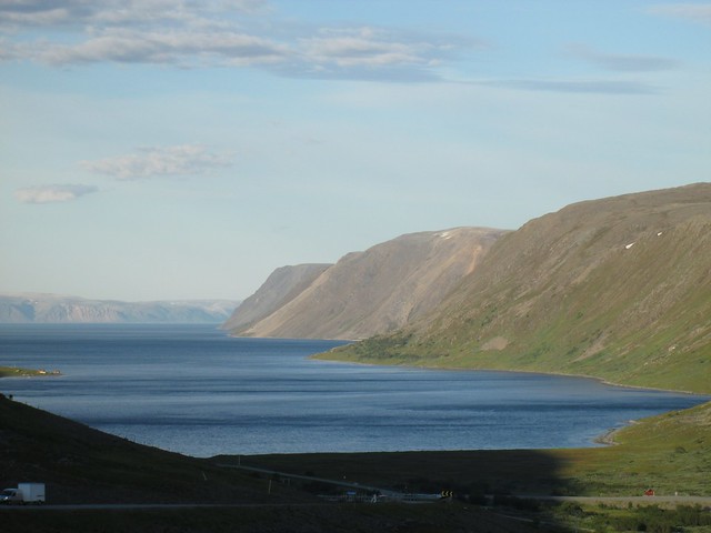
After 35 km the road dropped back down to sea level at Bekkarfjord, and the first human habitation I’d seen that day. In winter you can only use the road to Kjøllefjord by travelling in convoy, and Bekkarfjord is the place where vehicles assemble to form convoys which depart according to the published timetable.
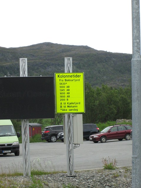
Convoy times
 Supermarket! and Cafe!
Another 20 km round the coast and I came to Lebesby, a fishing village with a church, a population of 85, and a small supermarket and a cafe. After stocking up I was stowing my purchases when Ole turned up. We went into the cafe and were the only customers. There were no staff, just a pot of coffee and some mugs, so I helped myself and left the money on the counter.
Often I pass through a remote place and wonder what life is like there. Here is an article on some of the problems facing Lebesby.
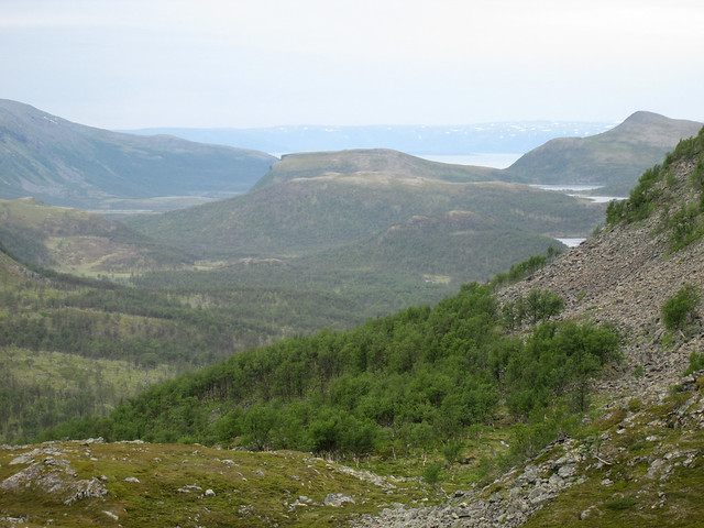
The Changes in an Indigenous SocietyAfter about an hour we set off again, and reached the junction at Ifjord and turned east on route 98 before Ole shot off again. The road crosses the base of Nordkinn peninsula and rises to over 350m (another strava top 10 - 7/7 on the strava segment at 6.2km/h). Another very bleak road, but without the sunshine.

Reindeer herding pens
GeorgeOn this stretch of road I met George from Romania and swapped camping info. He had ridden from Romania via Ukraine, Poland and Finland, and was heading for Nordkapp. I rooted around in the dustiest corners of my memory of my 2005 trip to Romania and wished him “Drum bun” (Romanian for “bon voyage”) before we continued our journeys.
George
Before the road dropped all the way back to sea level I pulled off the road and put up my tent among some stunted birches. Mosquitoes taking full advantage of the short summer were soon all over me, so I put up my tent as quickly as possible, dived inside and zipped it up. The only time I timed myself putting up my tent it was just over 3½ minutes - I'm sure this time was quicker. Once inside I examined my lower legs. The skin had a yellowish bruised look and my ankles were swollen - no doubt the work of the evil biting flies in the jungle at Hopseidet.
At about the limit of where trees can grow. Only birches have a hope.
At Lebesby they’d told us that the next supermarket was at Tana Bru, and that was still another 60km. I rode for a time with Ole. He had stopped further on than I had but had slept longer. After some ups and downs it was nice to follow the road south next to the broad River Tana. The low sheltered valley was forested, which made a change after the last few days. Tana Bru did indeed have a supermarket, so I stocked up and snacked before carrying on. The sun came out for an hour or so in the evening before I stopped once again amongst mosquito-infested birches. My ankles had swelled up again during the day, but were no worse than the previous evening.
Next day would take me to within a short distance of Kirkenes and I’d earmarked a campsite about 10km from the town. Again Ole came up behind me but unusually didn't want to talk, but zoomed off after up the road after only the briefest of greetings. I remembered this was the 30th, the day he was due to get his exam results.
IlyaAt a picnic table I met cyclist Ilya from St Petersburg who had arrived that morning from Murmansk by bus. He’d had no difficulty at the border getting into Norway, nor had the rest of the passengers, but the one person whose papers were not in order was the bus driver. He was tickled at the sight of tourists taking photos of the border post. He was going first to Inari in Finland then north to Nordkapp.

Ilya
At Neiden is the junction with the road to Finland. I’d need to come this way later. I didn't stop at the cafe but noted it for future reference. The day had started rainy but turned into a scorcher. According to Mrs Campsite it was 23°. That counts as a scorcher in these parts.
I checked in to the campsite and was lying in my tent resting when I heard shouting outside. “John! John!” It was a delighted Ole. He'd been into Kirkenes and read the email which told him he’d got the grades to study medicine. That evening he celebrated in the campsite kitchen/dining room with a huge meal of pasta, onion, fish paste and goodness knows what else he had found in Kirkenes.
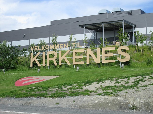
KirkenesThe following day I went to Kirkenes and had a look round. I went to the Hurtigruten quai, which is the very end of the E6. I also went to the tourist office, and realised that by far the biggest tourist attraction is the Russian border. There are bus trips, guided quadbike trips and boat trips to catch king crabs (which take you to within metres of the actual border). Many signs, especially on shops, are both in Norwegian and Russian, and many of the vehicles are Russian (mostly with Murmansk registrations).
Kirkenes is a long way from anywhere
The end of the E6, and the last port on the Hurtigruten route
From Kirkenes I carried on east about 10 km to the Russian border.
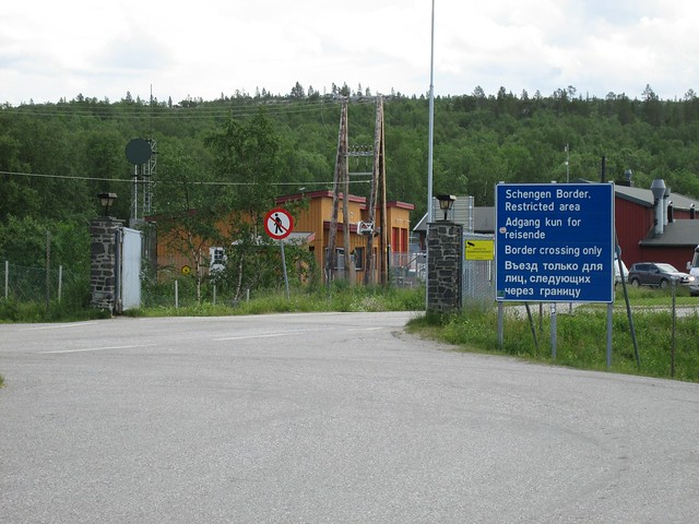
The Russian border. The “No pedestrians” sign was significant in the winter of 2015/16, but didn’t stop Syrian refugees without motorised transport.
Arctic route to EuropeThis really was the end of the first part of my trip. I’d gone as far as I could, from now on I’d be on my way home.
Next: Finland (and a little bit of Sweden)

