Coast to coast: 04-08 June 2008
PicturesSince the demise of Cyclefest, there's been a dearth of silly things to do in the summer. Oh, I know there's lots of silly things to do, but I mean things that I can do with my friends, who are few, and far between, these days. So, when Graham sent me an email in January, of the 'what crazy thing shall we do, then?' type, we concluded that instead of saying 'One day...' we'd say 'This year...'
Training has mainly been lots of commuting, some gym work, and longer rides - I did a hilly 38-miler on a split rim (easy, tiger) that I wasn't even aware of at the time. Come the end of May, I had a new rear wheel, new shorter stem, and newly fettled bike. By the 4th June, I had overloaded panniers and a sense of impending dread on the journey across to Whitby.
Graham's not a cyclist. That is, he rides a bike (upright; recumbent; tandem with his girlfriend) and does more touring than I've ever done, but if you ask him, he says he's a runner, or a rower, not a cyclist. There's not much spare flesh on him, and he travels light, and quickly. I'm more, kind of, well,
round these days. As Becky once memorably put it: "Team 'Very Short' meets Team 'Quite Tall, Really.'" Nick provided transport to Whitby for us and the kit, and would shuttle us back from Whitehaven at the end. Other than that, we were on our own.
I had the unenviable role of Navigator for the madness. I cooked up a route using a combination of Memory Map, Google Earth / Maps, and inspired lunacy. The version which John posted on the other thread is a 'work-in-progress' from the early days. The actual run was somewhat fluid right up to and including the days we rode - wiggle room to accommodate the unforeseen. At the end of this report I'll post the link to the Google Map which shows the final version of the route, mistakes and all. The Why? of the route is just that I like the symmetry of the C2C/W2W, but didn't fancy the route of any of the 'official' versions I looked at. Do something different, for no better reason than it is different.
I used Memory Map to print out chunks of OS, covering the chosen route. Half a side of A4 can easily accommodate about 12x9 km of 1:50,000, scaled to fit. The whole route fitted onto 18 half-sides, which lived in an A4 plastic file pocket. Folded into quarters, this was our bible for the route, and any deviations from it.
So, Whitby. By Crikey, who left that hill there? I thought I was going to die. Best part of two hours sitting in a car, and straight into a 4 mile climb on a hot day, with no warmup. The thought crossed my mind that if it was all going to feel like this, I might as well... Actually, I'm a bloodyminded little so-and-so, and there's no way I was bailing out of this, short of being airlifted out, or scraped off the road with a fish slice.
The A171 isn't a nice road. We took it because it got us where we needed to go, fairly quickly. There's a much nicer route via the Esk valley, but it's very crinkly, and it was already gone 1315 before we started. We had to get some miles in, and round-and-round-and-up-and-down wasn't going to cut it. I designed the first day as a shakedown to get the legs going and let us check that we weren't going to fall to bits. Out of Whitby, up the hill and onto the moors, past Scaling Dam, and on to the fishing reservoir, then left across Moorsholm, striking for Commondale. 17%, downhill, twisty, gravelly, nasty. The safety of 'up' on the other side. Then the same again, 20%, crossing the foot of Wayworth Moor, and again, finally rolling out across the railway line into Kildale.
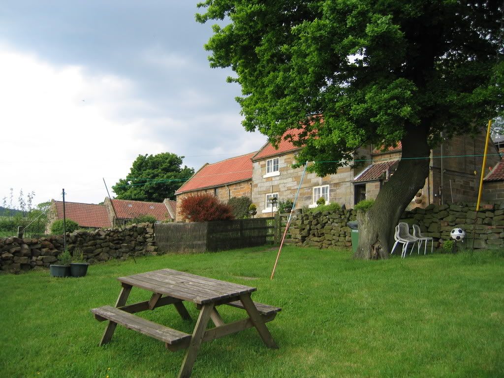
Park Farm at Kildale has a YHA camping barn, a small field (looked like a former orchard to me) for tents, and stables converted to showers and toilets, along with many sheep, cattle, two cats and a 6-month old cocker spaniel pup that ranks as one of the most bonkers dogs I've ever met. We were met by Carol. She and her husband run Park Farm, and his 71-year-old father still runs Low Farm across the fields. I hope I look that fit when I'm that age. She made us welcome, sorted us out with a pint of milk, and let us get on with it. After getting pitched up, and eating, we looked at how we'd done, and made our assessment for the following day. We sat around and chatted until the sun went down, and decided on a leisurely start in the morning.
Thursday: Up early, breakfast, a chat about the farms and their future (maybe getting out of cattle, little money in sheep, bluetongue vaccination), and we were off. In Stokesley we found the baker's shop, and loaded up with fruit and nut flapjack, then launched ourselves into the day proper. This was a rolling day, stretching out across the northern end of the Vale of York. Rudby, Crathorne, Appleton Wiske, the names sound so quaint as to be fake, but they're real enough. The land reminded me of farmland areas I've ridden around Evesham. Hornby! ('I wonder if they have trains?' asked Graham), East Cowton and heading for Scorton. The crackle of fast jet engines as a Tornado overflew us on training. A nasty bit of road near some kind of quarry, boxed into a wind tunnel by the untidy hedges; the bridge under the A1, and suddenly we were in Brompton-On-Swale. This had been one possible choice for the end of the day, but we're here by lunchtime. There's a bus shelter, some greenery, and a Spar. Cheese and pickly sandwich, orange juice and a rest in the shade, waiting for the moment when the heat starts to fade.
Up the hill to Richmond. Lose all that height dropping into the town centre, only to have to climb out the other side? not bloody likely. We took Quaker's Lane through the top of the town and dropped down on the other side: Hello Richmond, bye-bye Richmond, and we were gone. Reeth Road is a fast A-road, through a pretty valley, leading up the Swale to the junction with the B6270. Significant portions of the B-road border an Army training area, and the ground on the left is wild. We passed the remains of Ellerton Abbey, and hit Grinton. Over the bridge, round the corner and suddenly the road went UP. Good grief: Reeth.
Orchard campsite is by the river, which means that even to get to the pub, you have to climb. Peter and Pam are the campsite wardens. Pam was exercising the sit-on mower, in preparation for the weekend, whilst Peter bade us welcome. "Is it for charity?" he asked, so we explained the Justgiving page for the BHF. He gave us our pitch for free. Apparently, he had a heart attack last year, and his life was almost certainly saved by the Cumbria Air Ambulance (the Yorkshire one presumably being elsewhere), which got him to hospital in Middlesbrough in 12 minutes. As a result, his preferred charity is the Air Ambulance, and they have a collecting tin on the site. We gave him the price of the pitch anyway, to put in the tin. Fair's fair. In return he recommended the food at the Black Bull, if we were dining out.
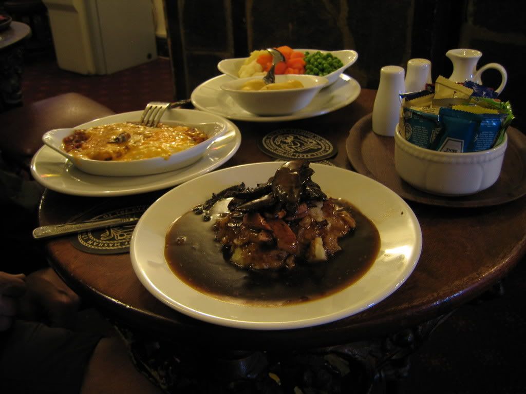
We pitched up, and I was just returning from having a shower, when the heavens opened. Rain, rain and more rain. You voluntarily stand under a showerhead, but if the rain comes, you zip the tent up. A peal of thunder. "Fancy a pub dinner, Graham?" Discretion being the better part of valour, and with a tough climb the next day, we opted for the pub. The food was good.
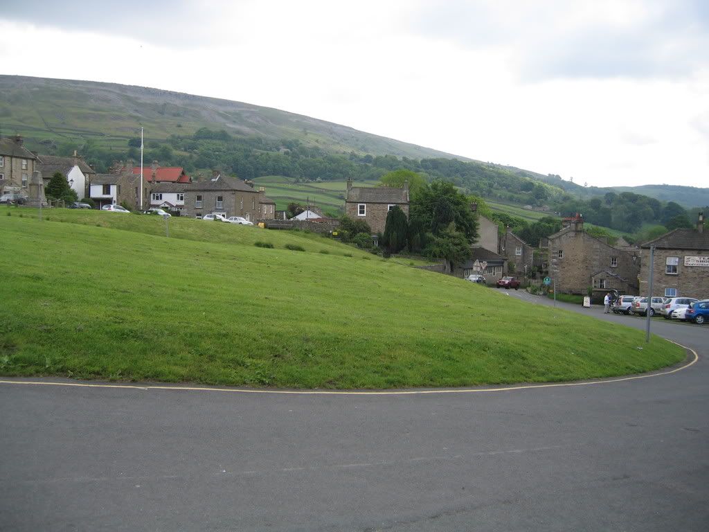
Reeth is dominated by a huge escarpment overlooking the town - Fremington Edge rises to 430 metres like a wall. Trust me, Google Earth doesn't do it justice. The whole town is on the cant, like some pissed architect went horribly wrong. It's a nice little village, but the flapjack was expensive - captive market in all the walkers doing the Wainwright C2C walk, I expect. It rained most of the night.
Friday was D-Day. Literally, being the 6th June, but also the bit I'd been worried about. First is the run up Arkengarthdale, which is a 6km drag up from Reeth to 330m, then down into Arkle Town and Langthwaite (~250m), then rising and dropping, over and over in similar fashion for the next 12km or so. The general trend is always upward, though, until you hit about 500m, at which point you're at the top of one of the bleakest green-grey moors I've seen in a while.
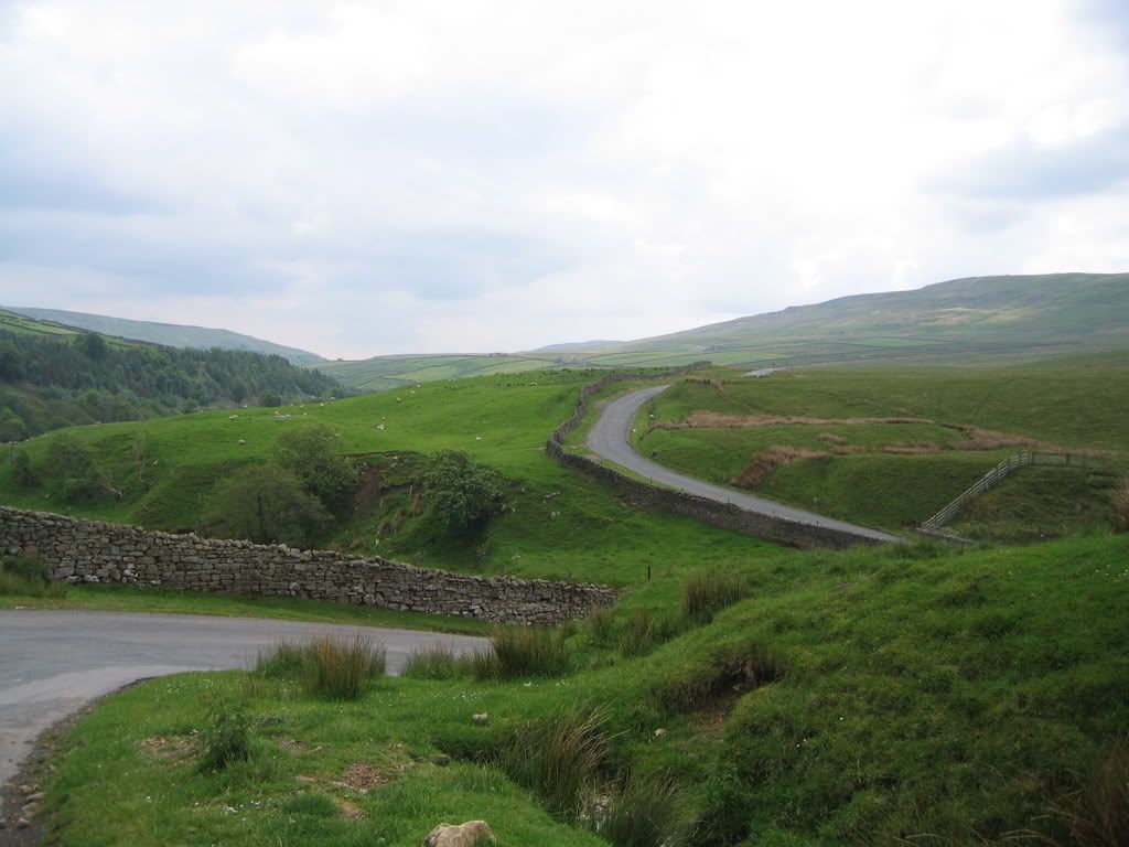
There are some sharp downhills within that climb, sufficient to plaster your front with passing wildlife. Every beck boasts its little colony of gnats, and after a while, so did my shirt. When one crawled into my eye, I had to stop. I'm not a hero - I walked some sections of the climb. This was supposed to be fun, not punishment. Tan Hill is not like a sharp Lakeland pass, but a long rolling and variable drag up the moors. Perfectly doable, if you've the legs - and you haven't overloaded!
Lunch at Tan Hill was a light bowl of soup and a roll, and a shared portion of chips. I'm not keen on heavy lunches whilst riding. It tends to come back up with a vengeance, and I'd rather not spend an afternoon feeling miserable for the sake of a dinner. After lunch we studied our route again. Appleby horse fair had put a crimp in our plans, as we knew that getting a camp site would be difficult. We had to make Penrith or its environs before stopping. Originally, the plan was to have dropped down into Kirkby Stephen, and then head off slightly west of north, taking in some of the NCN67 route. We decided to take a straighter line, coming off Tan Hill and taking the road to Brough, which meant we would then have to brave the A66. Not for the faint of heart.
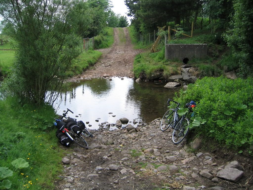
When we hit the A685 near Brough, the traffic was grim. My new phone gave us a hi-res version of the road layout (which was clearer than my scaled-down paper 1:50,000), and showed us we could hit the road out of Brough to Great Musgrave, without actually using any A-roads. A tunnel under the road, a couple of back lanes, and... a ford. Oops. Well, we're here now, and I still didn't fancy the A-roads. The water was clear and fairly shallow. Shoes and socks off, and a quick wade through. Flapjack and a regroup on the other side.
Off through Great Musgrave and on to Warcop, avoiding the A66 for as long as we could. We had to join it for about the last 1.5 miles into Appleby, but taking that road saved us some time, which we put to good use once we'd quit the town. Appleby during the horse fair is not a sight I want to see again. I'm sure it's quaint and interesting, and the town's probably fantastic on any other weekend of the year. I saw chaos, heavy traffic, heavily policed, and had no desire to spend more than the absolute minimum of time amongst it. Exeunt omnes, to the sound of hooves.
We now headed up through Bolton (no, not that one) and Cliburn towards Penrith, running on empty, and increasingly bothered about the lack of camp sites. We reached the junction with the A6 before Graham spotted a sign for a B&B. We trundled down the lane, and found the house, which had a field to the side with a boat, and a camper van in it. The owner let us camp, and furnished us with water. "Don't disturb my bees" he said, pointing to the hives. We promised to be good, and pitched up. Drizzle set in with nightfall, and with no facilities to speak of, we decided on a reasonably early start in the morning.
Saturday dawned grey and drizzly. A brew and a snack bar, wet tents and damp shoes. We loaded up and shipped out. A66 again, but early on a Saturday, before the worst of the traffic arrived. We found the side road which led us to the NCN71 C2C route and bailed out to the back roads. Mostly this was fine, lots of cyclists (all going the other way), but when we hit the point where it takes to the old railbed, it nearly killed us: From a 25mph downhill beside the A66, it suddenly pitches up and to the right with the dreaded "cyclists dismount" sign hidden in the trees. Yeah right. Some warning would be nice, about the short stop at a steep angle, with a closed gate. Sometimes I wonder about the sanity of the people who think that's a good idea.
We followed the railbed, now populated by walkers as well as riders, all the way into Keswick. Brunch was at the Lakeland Pedlar, along with a discussion of the remainder of the route. By this stage, my legs were long gone. Stamina was no problem, but sudden changes of terrain were giving me hassle - as long as I could maintain my cadence, I was fine, but there were points now where I was conking out, and finding myself needing to walk hills that I should have been able to ride. We took our time over the lunch break. Rest and digest were the order of the break, so we went to sit in the park for a while. We decided to again follow some of the NCN route, but to take the A66 along Bassenthwaite lake for a section. I needed a small front changer end-stop adjustment as we left Keswick - the only mechanical of the whole run - and then we were off.
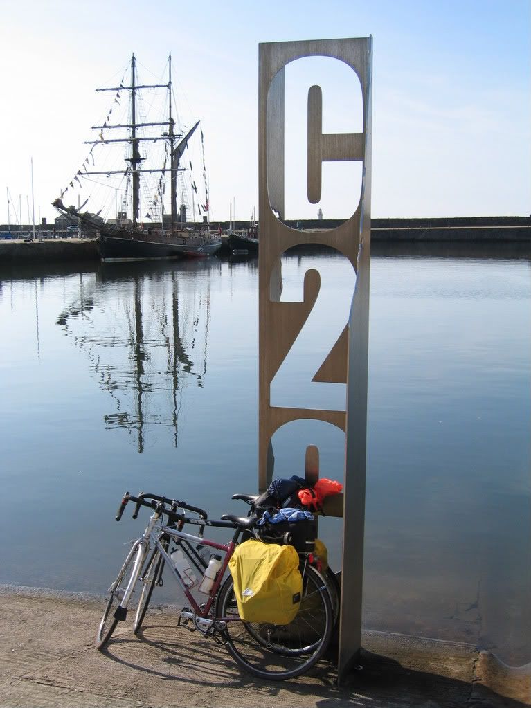
Where the NCN route touched the A66 again, we took that all the way round from Bassenthwaite to the Lorton turn-off. This section of the road wasn't as bad as the previous day, apart from some drivers thinking it's a racetrack. No change there, then. We headed left down the A5086, and took the turnoff for Dean, then Ullock, and Branthwaite. We ate our last supplies of snacks and chocolate to cheer ourselves up for the last run into Whitehaven. This was down the A595, which again, gave us the best run in. By this time I was positively avoiding the NCN routes, simply because our experience was that they went out of the way, were often poorly surfaced, and suffered from being 'leisure' paths, rather than routes to a destination. We rolled up and down the A595, took the right turn for Whitehaven, and rolled down to the waterfront, landing at the quayside at about 1715. Finished.
Total trip meter reading was 163 miles, with an average speed of a shade under 10 mph over the whole journey.
Good Things: The weather, the views, the company, Nick for doing the shuttle, the ford, the N82 showing me what the map didn't, Andy and Mo's B&B in Whitehaven for giving us a soft landing and a great welcome.
Bad Things: The A66, Appleby, roads that go 'up' and idiots in cars.
Would I do it again? Like a shot, but with a lighter load.
The route
