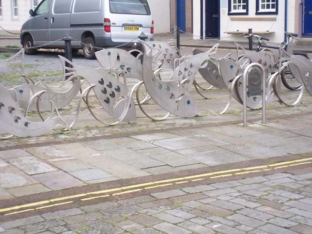
Day 2 - the Cumbrian coastThe day started sunny, with a light NE (head)wind. This was my first experience of NCN & I decided to avoid 2 stretches of sandy track by the sea by taking the “unsigned on road temporary” alternatives. The second of these, by Sellafield, proved too difficult to navigate with only the Sustrans map & OS Road map 4. I diverted along the B road to Gosforth and was rewarded with a magnificent view up Wasdale, with Scafell Pike & the surrounding peaks capped by clouds. HCW was rejoined at Beckernet, an attractive village. The views of the Lakeland fells continued all morning, though the sea disappeared behind St Bees Head and the ridge that runs northwards up the coast. Whitehaven’s port is squeezed into a surprisingly small gap in the ridge. I spotted an unusual bike stand on the quayside – not heavily used…
Continuing north, Workington proved unmemorable apart from a brief shower. I lunched at Maryport, the half way point in the day’s ride. By now I was about an hour behind schedule, due to the navigation error, the headwind, and the general slowness of the off-road route. Maryport has the Senhouse Roman Museum, which I planned to visit. I saw no signs to it, and by the time it was clear that I had missed it, it seemed easier to press on & catch up with the schedule.
The route continued up the coast, with a few inland diversions, but was now heading northeast. The wind meanwhile had backed to SW and was behind me. Silloth, the next town, proved to be a quaint, but rather run down, left over from Victorian times. The cobbled main street was lined on the landward side by guest houses & hotels facing the Solway Firth & the Sottish hills beyond. I stopped briefly to buy fruit.
After Silloth the terrain became quite flat. The route meandered around the indentations of the Solway shore. The falling tide was exposing vast areas of mudflats, providing a rich feeding ground for many wading birds. By Anthorn two curlew took off and crossed the road just in front of me, providing a close-up view of their improbably long decurved bills. Out on the Firth, other curlew called, an evocative sound of wild unpopulated places.
I eventually reached Bowness-on-Solway, the day’s destination. The village is on a small hump, largely within the outline of the Roman fort of Maia. This is the western end of Hadrian’s Wall. I located the B&B and had just finished unloading when the heavens opened, to be followed by rumbles of thunder. My landlady at Maia Lodge, which I recommend thoroughly, marvelled at my luck.
A quick change & it was time for food at the King’s Arms. It was bustling with walkers, weary but quietly celebrating the completion of the trail along the wall from Wallsend. I reflected that my 80 miles riding had managed to miss all signs of the fortifications that the Romans had built along the coast to Ravenglass. Outside, the sun was setting, the red-tinged clouds reflected in the Firth promising fair weather for the morrow.
Day 3 – Bowness to Twice BrewedA sunny morning with a forecast of showers later encouraged me to make an early start. However it took a little time to do justice to the splendid English breakfast. Moreover the other two guests were Dutch girls who had just completed the walk and we spent some time sharing our experiences. Eventually I started to pack the bike, but was halted by the appearance of a greater spotted woodpecker taking nuts from the bird feeders only 5m away. It seemed untroubled by my presence, evidently being more interested in a good breakfast.
At last I headed east, blown by a moderate tailwind. The road follows the line of the wall in places, but there are few visible signs. The Firth turned into the River Eden. Approaching Carlisle, the HCW route alongside the Eden is unrideable, so I stuck to the roads. I stopped in the city centre to buy a baguette for lunch, having gained a lot of time, but a little concerned that an average of 95 rpm might be a bit high. As I emerged from the sandwich shop, a passing man enquired about the Claud Butler, a process to be repeated several times during the next two days.
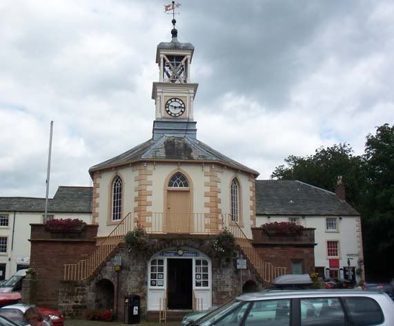
I rejoined HCW, directed by a strategically-placed sign that had presumably been put there by a Sustrans Ranger. The shared use path out of Carlisle was not ideal, being very badly overgrown on the bike side, and suffering frequent tactile strips. These latter proved to be as hazardous as tram lines in the damp and rather slippery conditions. Fortunately the rest of the day was almost entirely on roads. The route meandered alongside the Eden for a while before aiming for Brampton through quiet undulating lanes and a series of villages. Brampton proved to be a bustling little town, with an attractive main street. In the centre is the old Moot Hall,
now home to the TIC, where I stopped and chatted to a couple of cyclist who were about half way from Dover to Durness – most impressive.
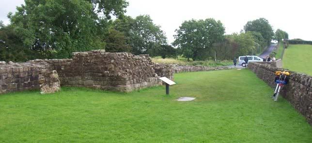
The route climbed out of Brampton before a rapid descent to cross the River Irthing at Lanercost. I passed the Priory, saving it for another day, and laboured up a stiff climb to Banks. Here the route rejoined the line of the Wall and Roman Masonry was clearly visible.
The route continued along the line of the Wall to ruins of Birdoswald fort, which I had planned to visit. The rain had now started in earnest. I covered the saddle, locked the bike & dived inside the visitor centre, joining a queue of other escapees from the rain. A quiet corner for lunch was shared with a veteran time-triallist a decade or two older them me. I explored the museum & fort at leisure while the rain moved off to the east.
As I left I was stopped by a middle-aged, former fixed wheel rider, who seemed to know more about the technical details of my bike than I did (not that hard). We chatted for a while – he was very enthusiastic to see an old touring frame put to good use.
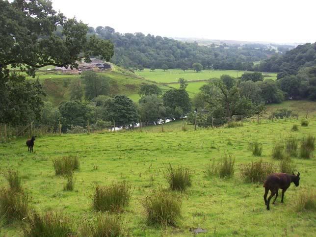
The road turned briefly north away from the wall before turning eastwards towards Gilsland. I stopped to admire the view of the Irthing valley and suddenly realised I had picked a perfect viewpoint for a long surviving section of the Wall by the river crossing at Willowford.
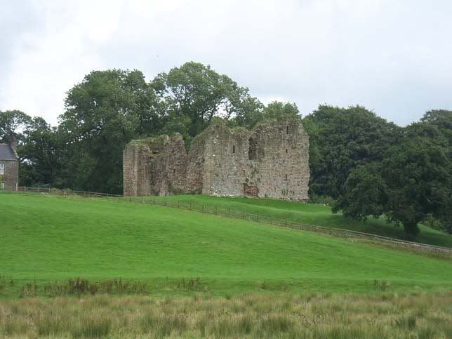
Gilsland & Longbyre were followed by another good viewpoint, in this case of Thirlwall Castle, which is mostly built with stones robbed from the Wall.
The rivers were now flowing east, which should have meant riding downhill. However, the route out of Greenhead was one of the steepest climbs of HCW. The surface deteriorated rapidly so I walked, looking thoughtfully at the road alongside, which was well surfaced and graded more evenly. After this, the descent to the South Tyne valley at Haltwhistle was a suitable reward. Haltwhistle claims to be the geographic centre of mainland Britain. It has several rows of stout Victorian stone terraced houses and is not, as Mrs. N’s cousin put it pithily, a place where you’d get a gin & tonic, but it’s obviously a thriving little town. The TIC, housed in former station buildings, is a centre for HCW.
I stopped to buy a newspaper and then continued down the Tyne valley, following the old main road as far as Bardon Mill. At this point HCW turned north, climbing up to the line of the Roman Stanegate, which pre-dates the Wall, at Smiths Shields. The route up had been chosen to give a gentler gradient than the more direct roads, but the 130m climb was hard work & I was quite relieved to leave HCW to stop at the visitor centre at Once Brewed. From there it was a short ride to my overnight stop at the Twice Brewed Inn, my legs feeling much wearier than the day’s 51 miles really justified.
Day 4 – Twice Brewed to South Shields (and a bit further)
The bedroom window faced east and the rising sun woke me a little earlier than planned. I breakfasted, left Twice Brewed and rejoined HCW along Stanegate, passed the fort at Vindolanda and climbed up to the highest point of HWC.
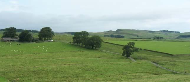
From this viewpoint the Wall was visible for miles, running along the top of the Whin Sill.
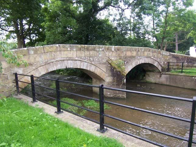
The road descended gradually from there, following a long ridge with memorable views on both sides, before taking a rather circuitous course down the North Tyne valley and into Hexham. Hexham needs at least a complete day to explore, so I continued on to Corbridge, a delightful town that Mrs N. & I had already visited several times, and then to Ovingham where I spotted a splendid narrow old bridge over Whittle Burn.
The bridge over the Tyne was also very narrow – the Sustrans guide notes advise “If using road bridge ride down the middle to prevent cars trying to overtake and ignore the car horns!!“.
The next 5 miles were along an old wagon way that had been built before steam railways. I stopped to visit a small stone cottage where George Stephenson was born. The National Trust guide treated me to a fascinating history of the Stepehensons and the cottage. The route continued down the Tyne, the scenery increasing dominated by structures from the area’s long industrial history.
Lunch was on the quayside in Newcastle, almost directly underneath Robert Stephenson’s High Level Bridge. This has recently re-opened to road traffic after some 3 years of major structural repair work. It was difficult to imagine the area in the days when the Roman bridge was there. I reflected that the Romans, who were superb engineers, had long ago identified that this is the best place to bridge the Tyne.
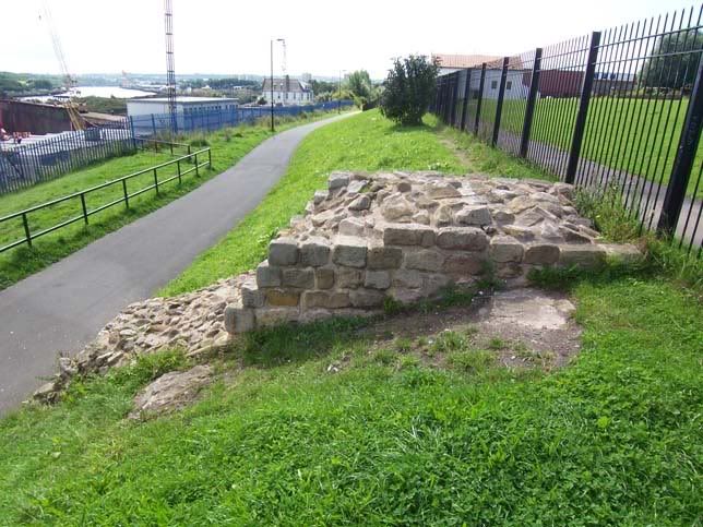
I continued east on the shared-use path of the quayside, riding cautiously through the crowds of pedestrians. I tried the road alongside for a couple of sets of red traffic lights before accepting that hurrying through dense traffic is a futile in pedestrian traffic as it is in the motorised variety. The route left the city centre and wound its way along the Tyne, reaching Wallsend, site of the recently excavated fort of Segedunum. At this point the Wall turns south to end down on the river bank. A fragment of masonry remains.
HCW continued east beyond the end of the Wall, eventually reaching North Shields, to cross the Tyne on the Shields Ferry. One of the ferry crew, obviously a cyclist, noticed my double-sided rear hub and we chatted for a bit. A mile or so after disembarking I reached the end of the trail, the Roman fort of Arbeia.
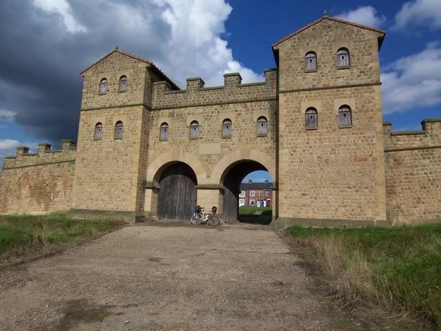
The gateway is a recent reconstruction, but is a graphic reminder of the scale of Roman masonry from an age when timber buildings were otherwise universal. I looked round the museum, which had been closed when Mrs N. & I visited the site, feeling a sense of achievement mixed with an element of anticlimax that there is so little to mark the end of HCW itself.
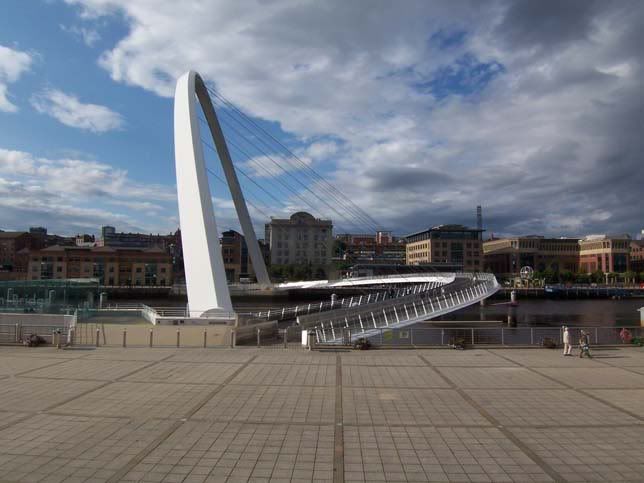
It was then time to ride back to Mrs N’s cousin’s house in Gosforth. I had planned to ride along the south bank of the river and cross the Millennium Bridge, but now added a ride across the High Level Bride to my itinerary. I set off along NCN 14 & got lost several times. The signage along HCW had been very good. This was not up to the same standard. I took to the roads, aiming for the Sage, known locally as the silver slug, now clearly visible on the Gateshead quayside. Eventually I made it onto the bridge.
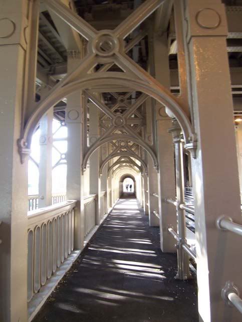
It was then a short ride to cross Armstrong’s swing bridge, the oldest of the existing bridges. I scrambled up to the High Level Bridge, its interior vaguely reminiscent of a gallery in a mediaeval cathedral.
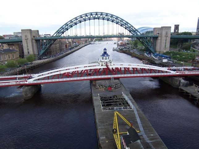
The mid point provided a good view of the bridges downstream.
Finally, I battled uphill through the rush hour traffic and reached Gosforth exactly 70 miles since leaving Twice Brewed.

