Fords (and
low water crossings). In this topic, photos should show:
- a cyclist riding through
- while there's water flowing (no fair riding it when it's dry!).
Bonus points if the cyclist falls in.
I'll start with the low water crossing near Shaftenhoe End in Hertfordshire. The brook, labelled "Comberton Bottom" on OpenStreetMap, and which delineates the boundary between Cambridgeshire and Hertfordshire, is culverted, so normally the road is dry (
as seen on Google Street View), but after weeks of rain have saturated the fields, a storm can cause the brook to overflow the road.
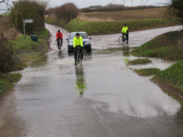
(Cyclist: me. Photo: Nigel Deakin. The car was parked up because the driver had dropped his glasses in the stream when he was out jogging earlier in the day. I thought he had no chance whatsoever of finding them, but I was wrong.)

